


Archived News
Ping DSP on the Cover of Sea Technology Magazine!
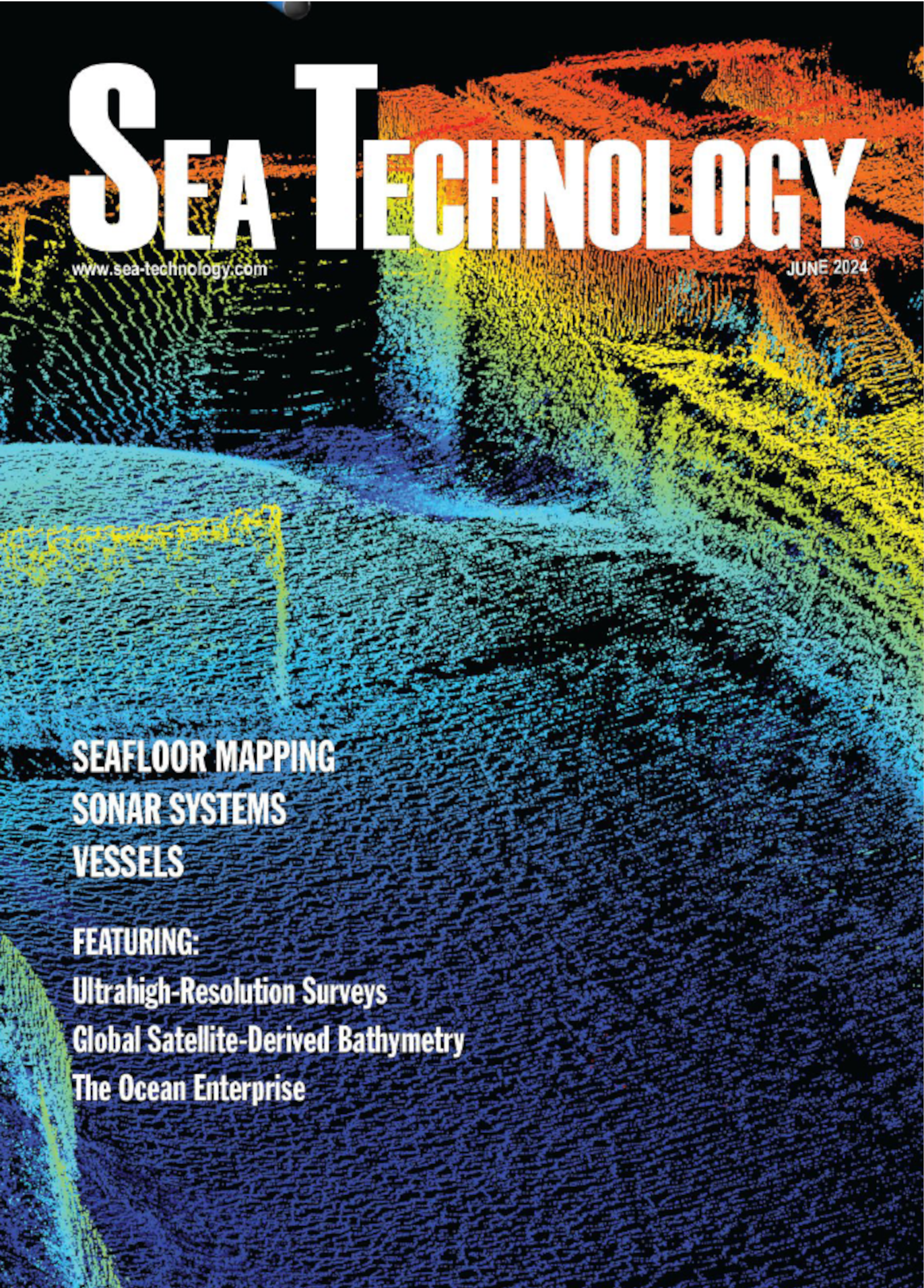
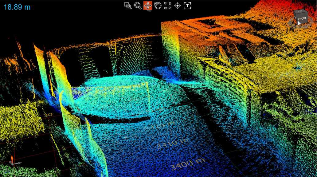
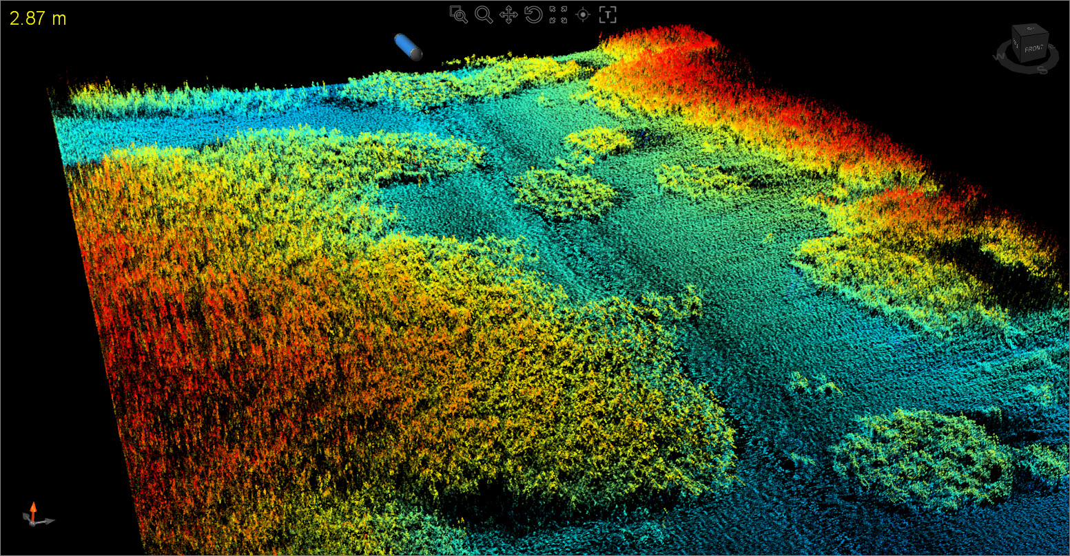
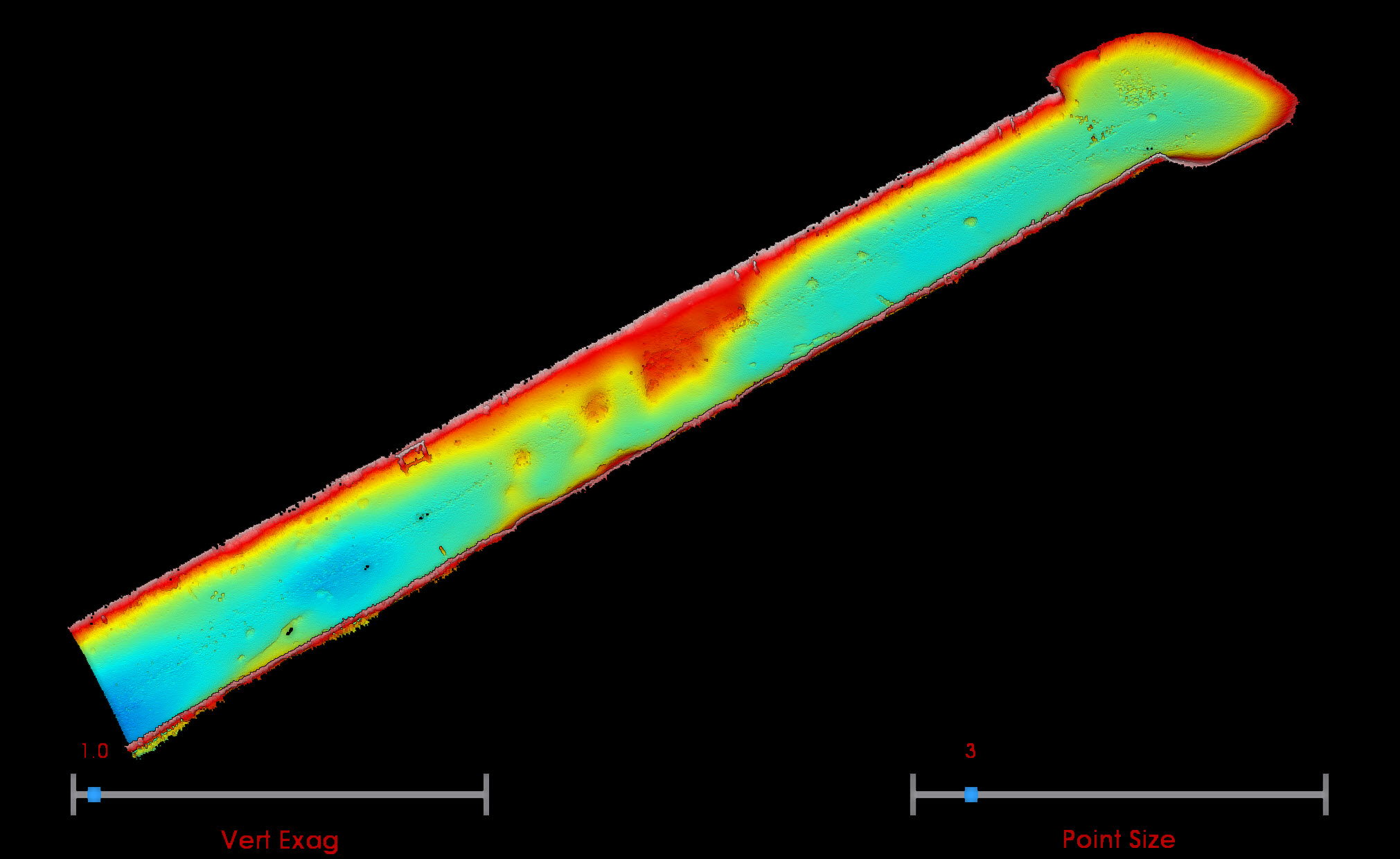
Ping DSP’s 3DSS data made it onto the cover of the June issue of Sea Technology magazine! The cover image features 3D-imagery data taken from our March 2023 virtual demo of Cascade Locks Marine Park. The 3D imagery clearly depicts the lock and other structures. Even small features, like staircases, are clearly recognizable in the data.
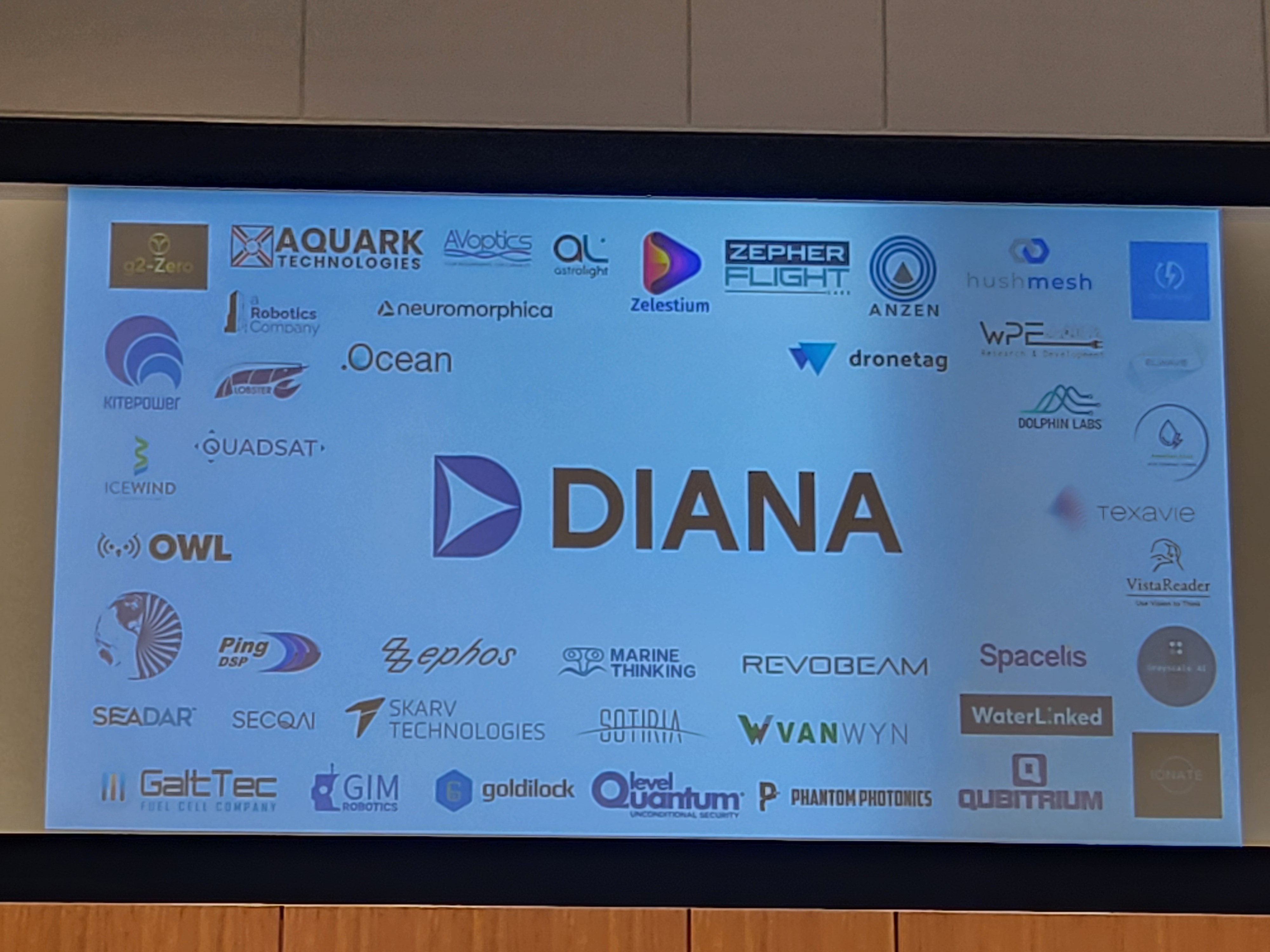
DIANA Demo Day - Seattle, WA.
NATO DIANA’s accelerator program through PNW MAC culminated in Demo Day: an opportunity for the innovation cohort companies to present their technology. The 3DSS was on display along with other amazing innovations from the cohort companies. We had the opportunity to give a short pitch, which we have been practicing throughout the program. This was followed by an opportunity for military and industry leaders to ask questions and explore the displays.
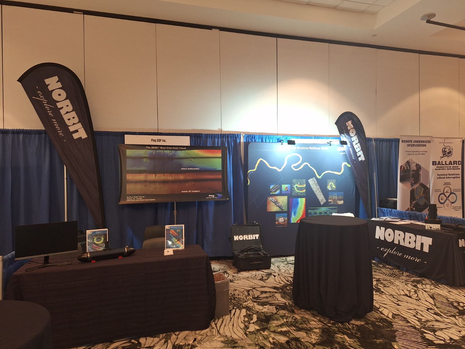
Canadian Hydrographic Conference 2024 - St. John's, NL, Canada.
We had the privilege of sharing a booth with Norbit Subsea for the Canadian Hydrographic Conference. It was great to see them and connect with many of our customers and reps.
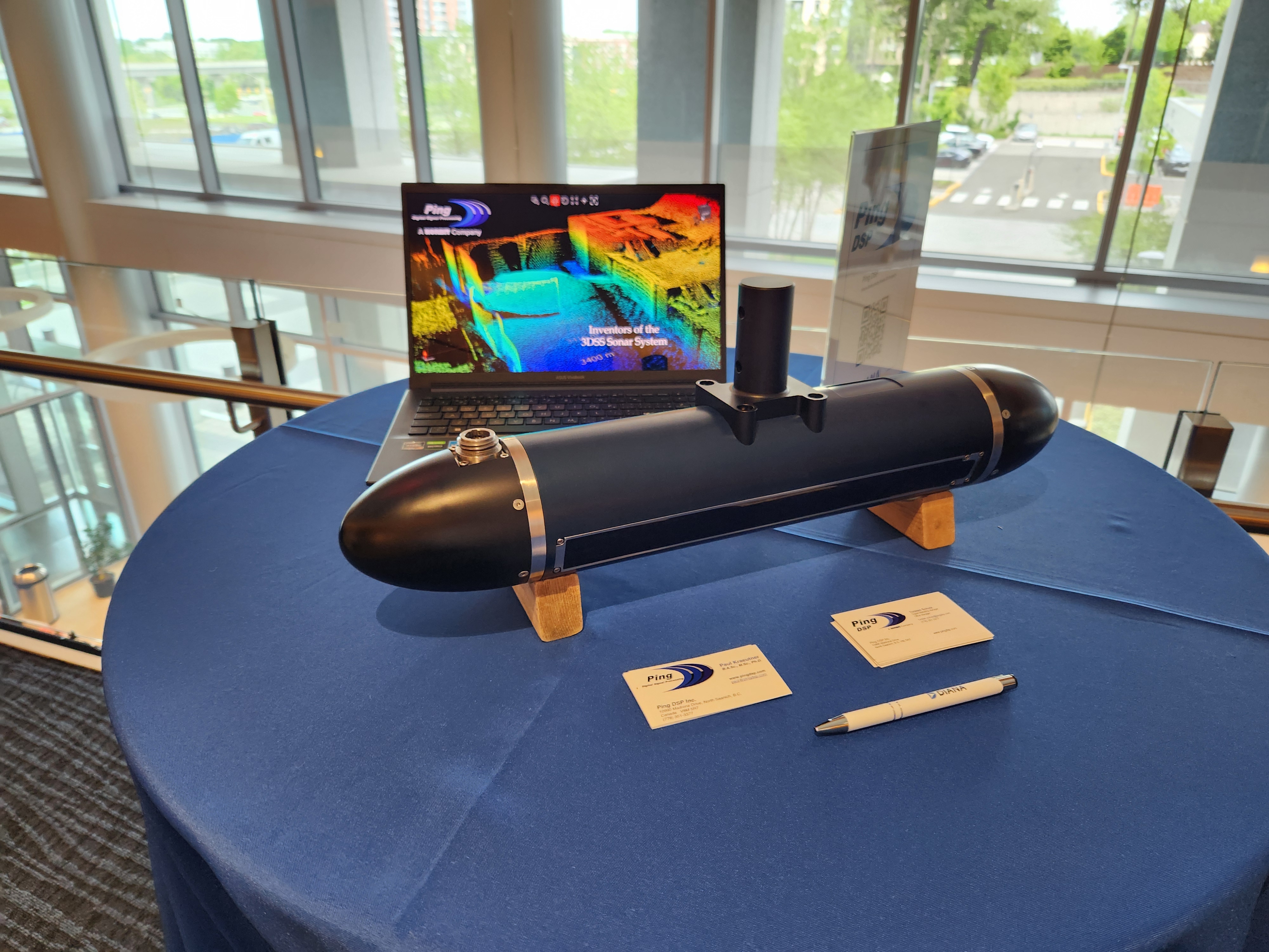
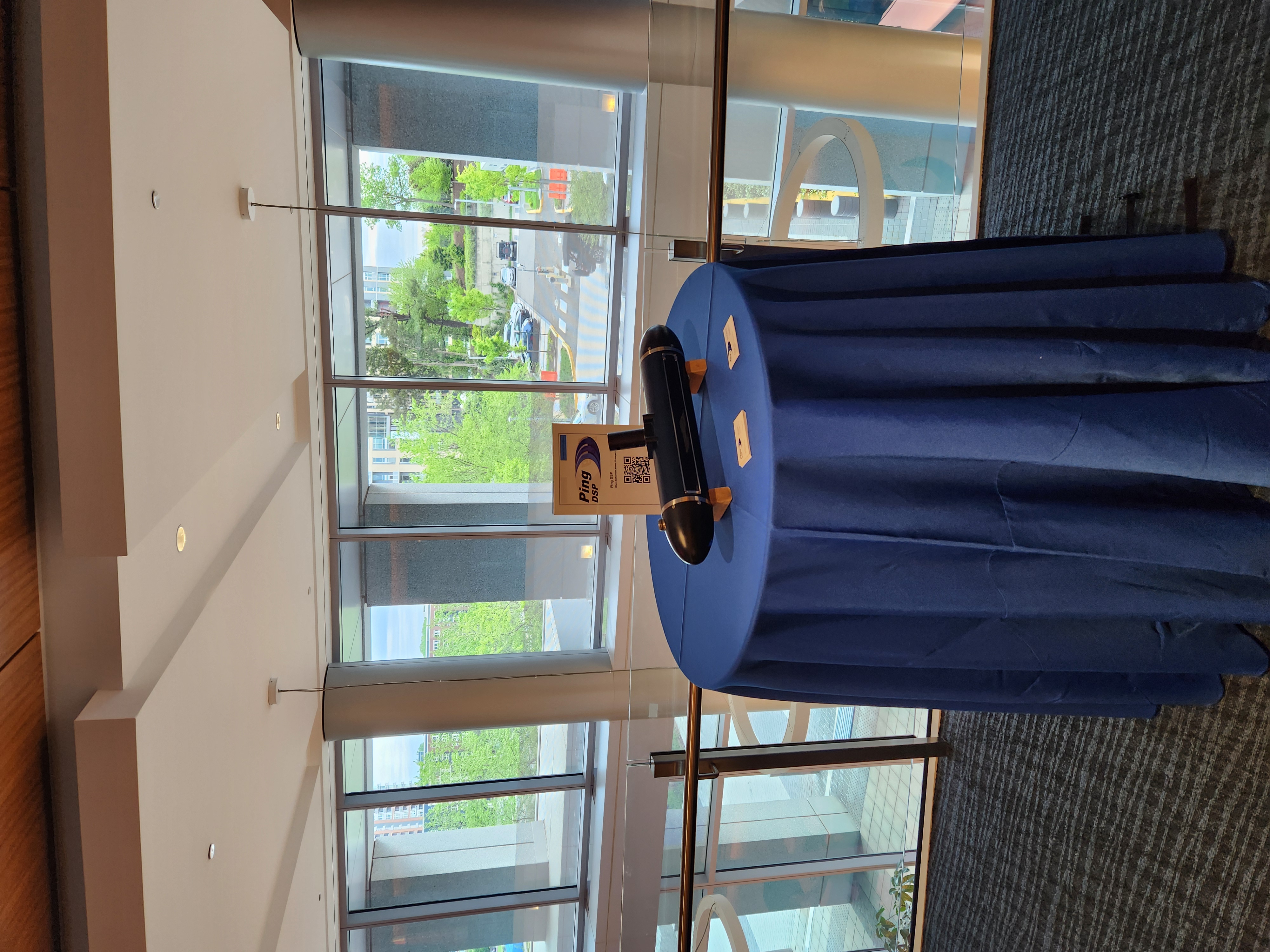
NATO DIANA Outreach Days - Washington, DC.
Ping DSP was fortunate to be able to attend NATO DIANA’s Outreach Days in Washington, DC. This event was a chance to put the 3DSS in front of military and commercial end users who would be otherwise out of reach. It was also a great chance to connect with many of the other innovators in the DIANA program. We attended a similar event in Amsterdam in the Netherlands in March of 2024, which was also very successful.
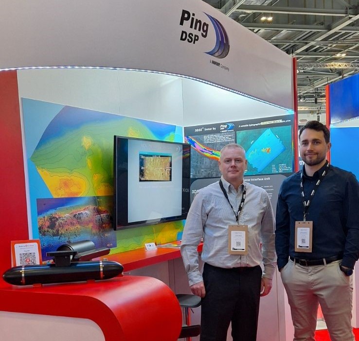
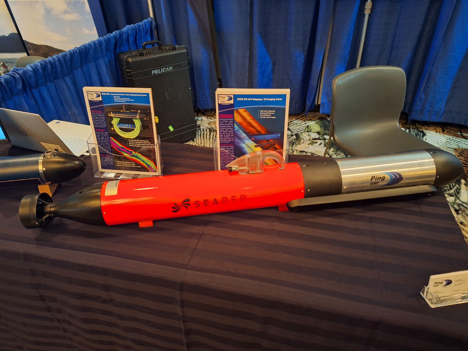
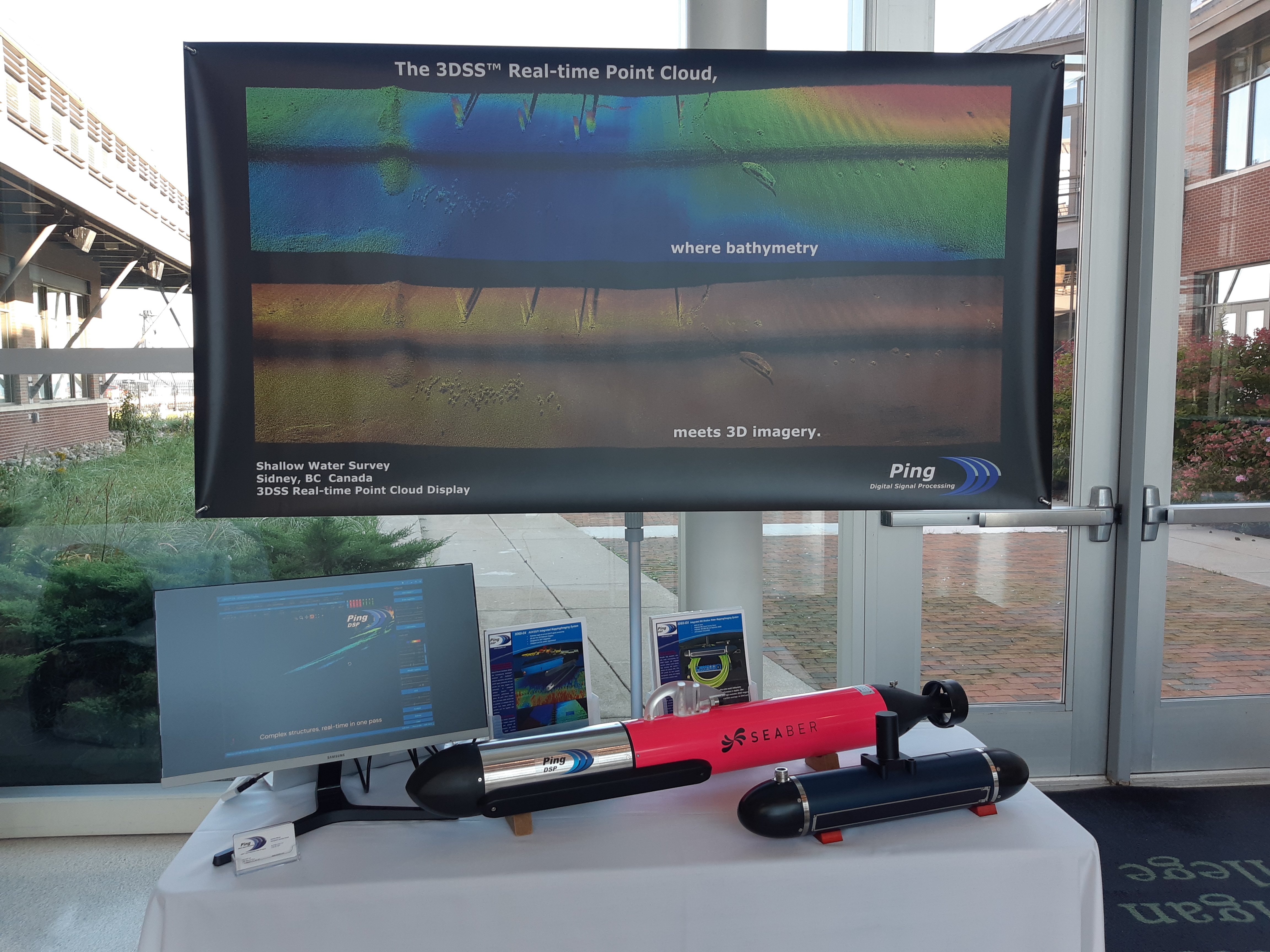
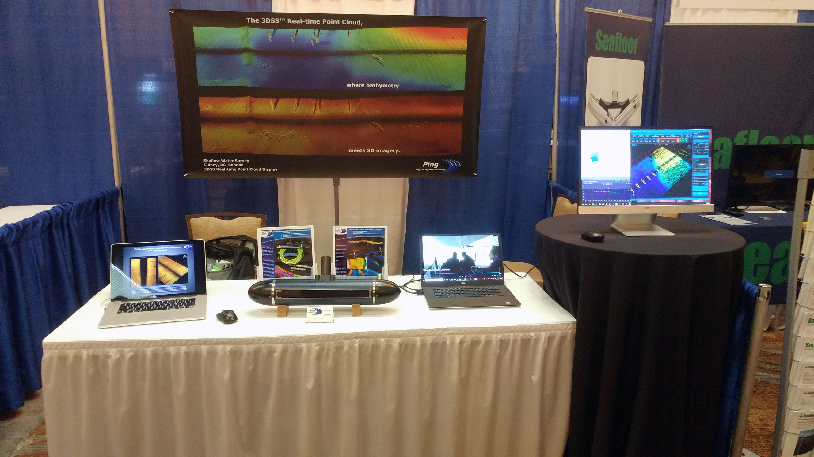
Oceanology International 2024 - London, UK.
James and Kurtis had a great time at Oceanology International 2024. It was great to see many of our costumers and partners at the show. Alongside the 3DSS was our new collaboration with Seaber: a 3DSS module for their YUCO AUV. The new product is still in development, but we have hopes of announcing the launch later in 2024.
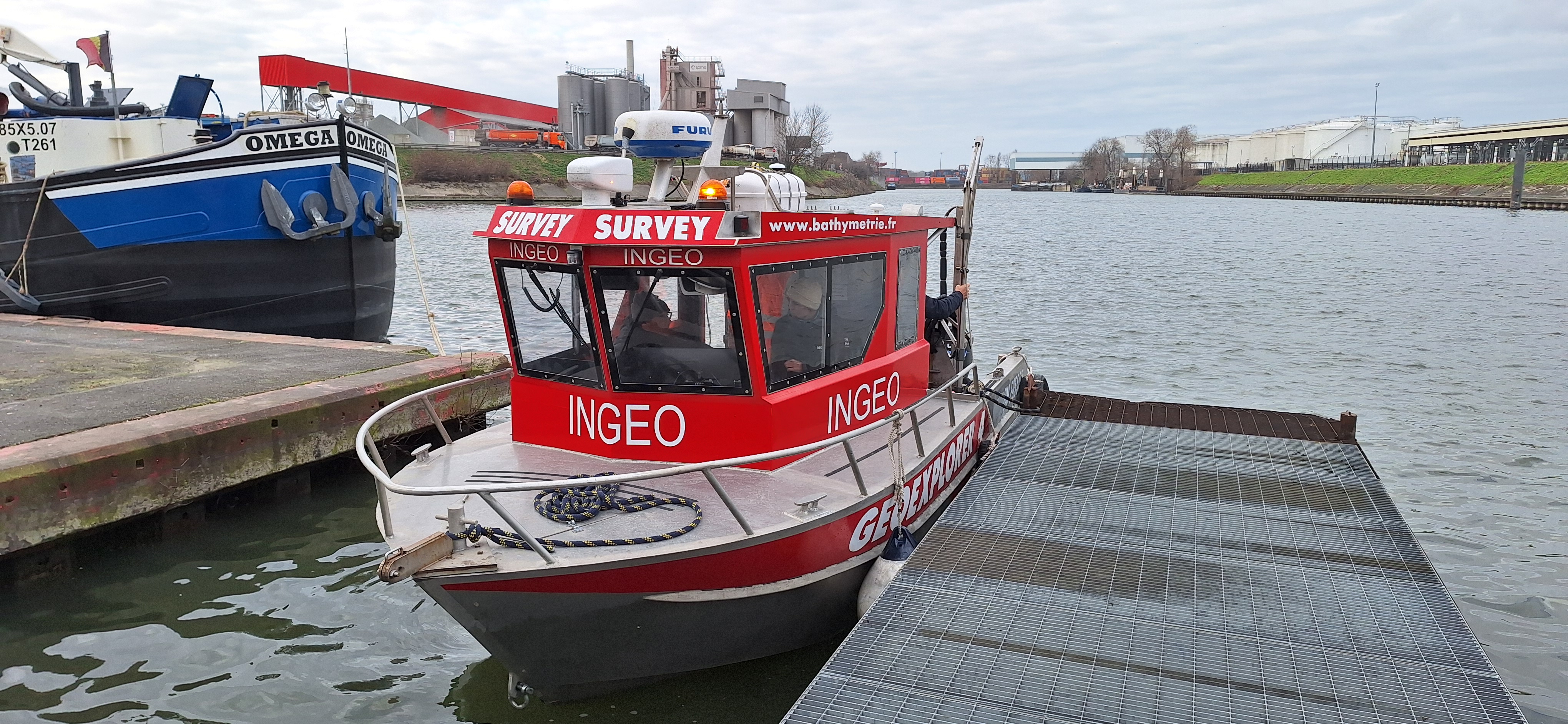
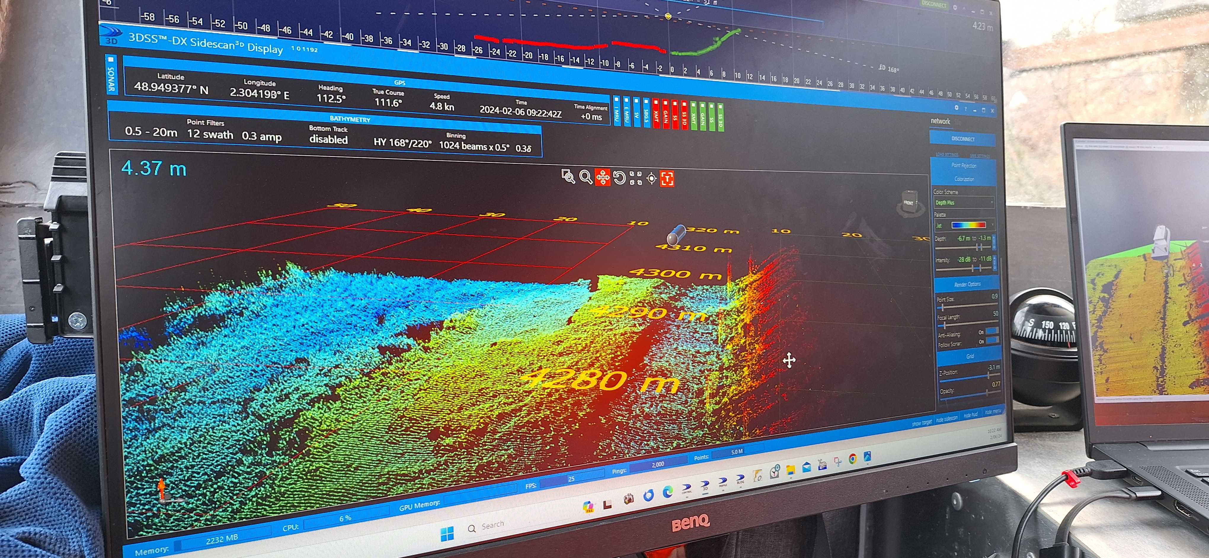
Seine River Demo - Paris, France.
With the help of NORBIT Sunsea, we had the opportunity to spend two days on the Seine River in Paris, France. We took several potential customers out to see the 3DSS in action and had a chance to do a complete survey of a portion of the river. Reach out to us if you’re interested in seeing the results!
Hypack 2024 - Savannah, Georgia.
Ping DSP was at Hypack 2024 right next to Norbit Subsea. This was the first time the two companies have exhibitioned together since Ping joined the Norbit family back in November. We were pleased to display a mockup of our new collaboration with Seaber: a YUCO USV with an integrated 3DSS. We are very excited to launch this new vehicle in the coming months!
NATO DIANA Innovation Accelerator.
We are very excited to have been selected as a participant in NATO’s inaugural Defense Innovation Accelerator for the North Atlantic (DIANA). DIANA aims to solve complex security and defense problems through collaboration and innovation. Of the 1,300 applications that were received, we are honoured to be selected as one of the 44 organizations to participate. Our proposed solution will address the Sensing and Surveillance challenge, and we are very eager to begin work on the project in January.
In addition to funding, DIANA offers an Accelerator Program, which will give us access to experts, facilities, and resources from throughout NATO. We look forward to working with DIANA and our new NATO partners to significantly impact and advance underwater environmental visualization and object detection.
Stay tuned for updates in the coming months!
Partnership with Norbit Subsea.
Ping DSP is pleased to announce that it has joined the Norbit family. Norbit is well known for their multibeam sonar systems and other underwater solutions. With Norbit’s help, we hope to further promote the 3DSS and explore new applications for underwater 3D imagery. We look forward to a long and prosperous partnership.

Lakebed 2030 - Traverse City, Michigan.
Ping DSP attended the Lakebed 2030 conference at Northwestern Michigan College. In addition to the 3DSS, we were excited to announce our partnership with Seaber. We are looking forward to completing our integration on their AUV sometime in 2024.
Second Online 3DSS Sonar System Demo.
We had another successful demo thanks to Telestra Technologies, this one was on Lake Monroe near Deltona, Florida. We focussed on the capabilities and settings of the 3DSS while observing the underwater environment of the lake.
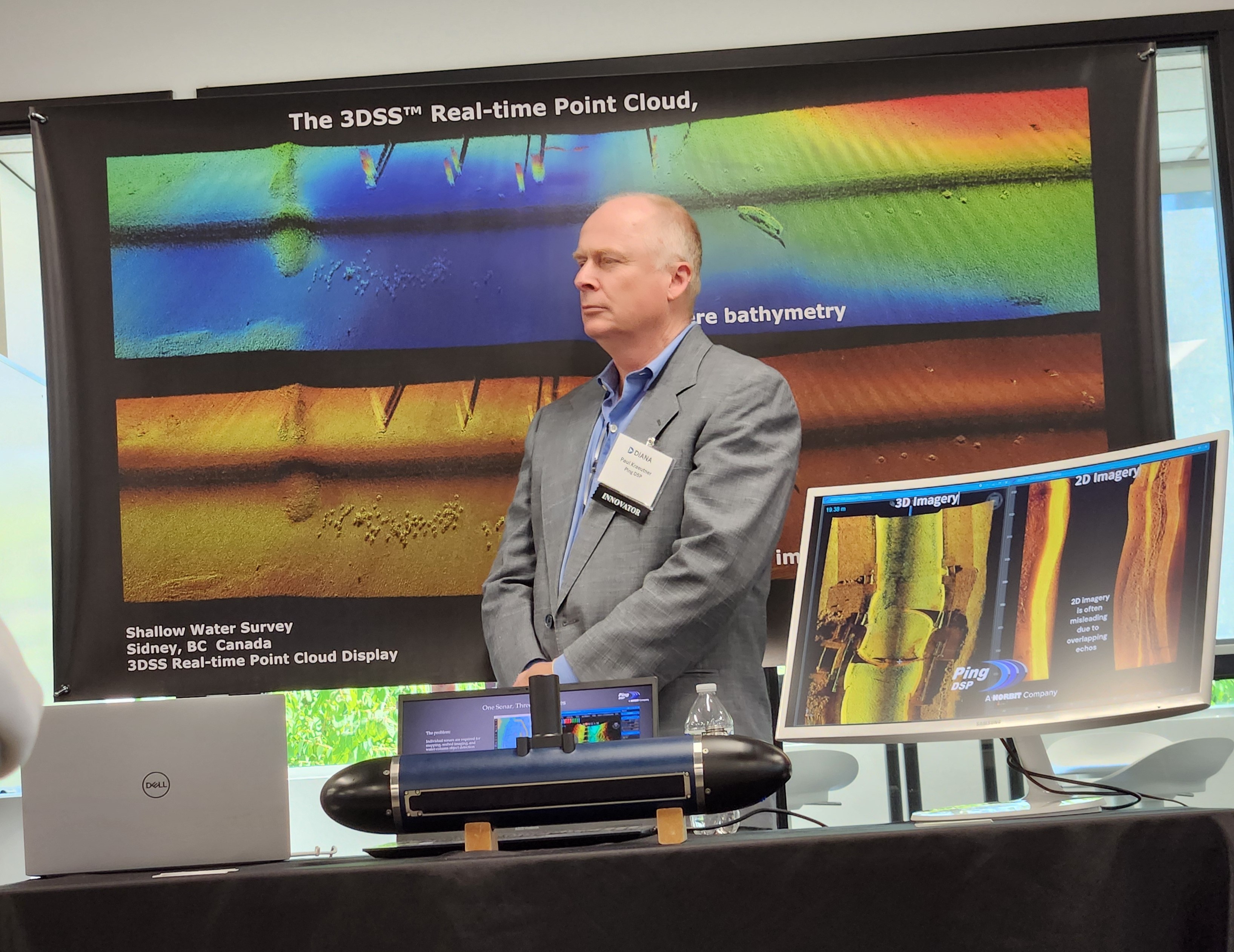
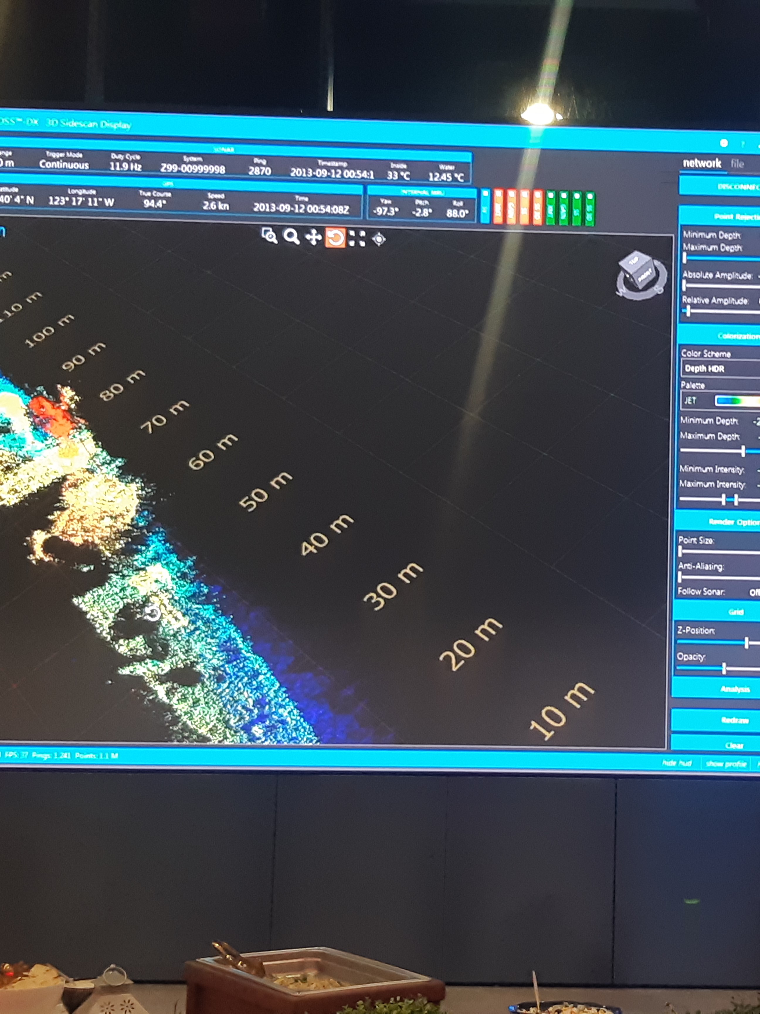
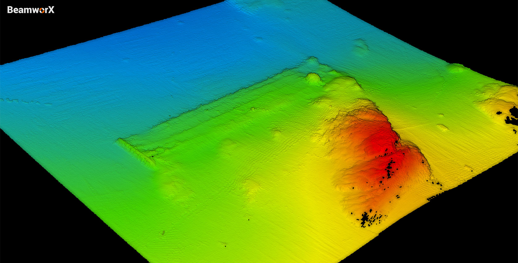
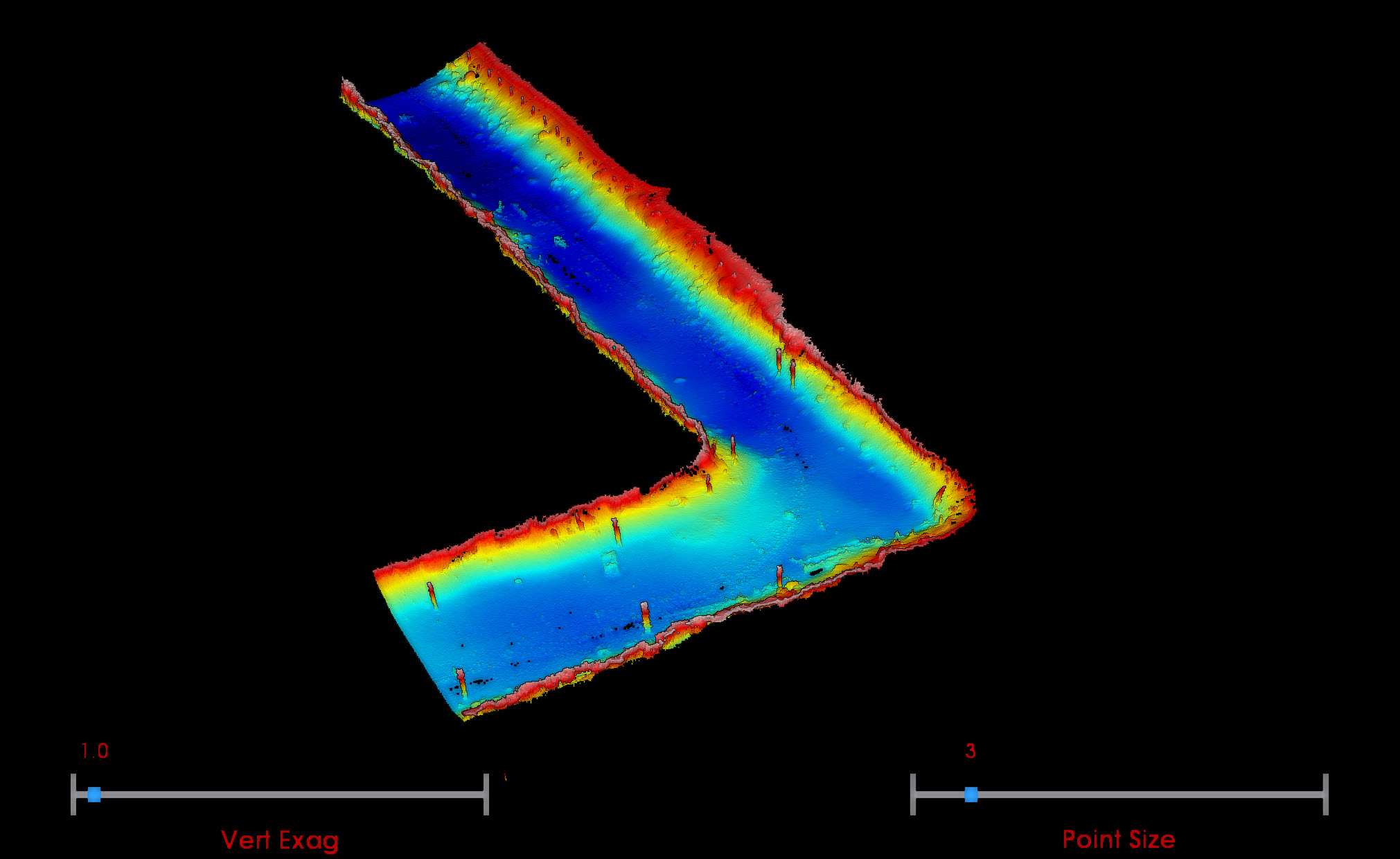
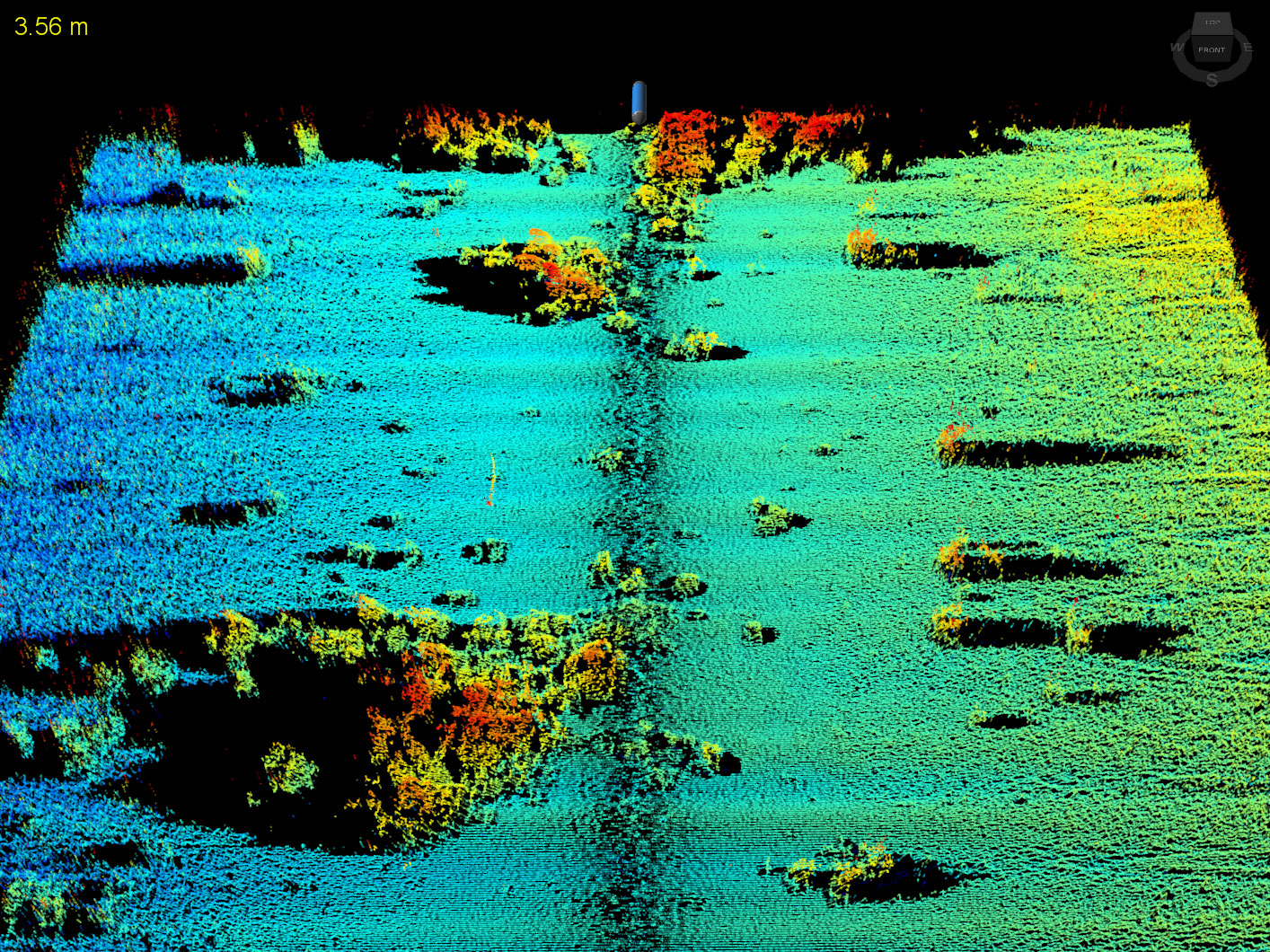
Online Demo of the 3DSS Sonar System.
Thanks to Telestra Technologies and Northwest Hydro, we hosted our first virtual demo at Cascade Locks Marine Park on the Columbia River. We surveyed an abandoned, submerged lock and the 3DSS produced some amazing 3D imagery.
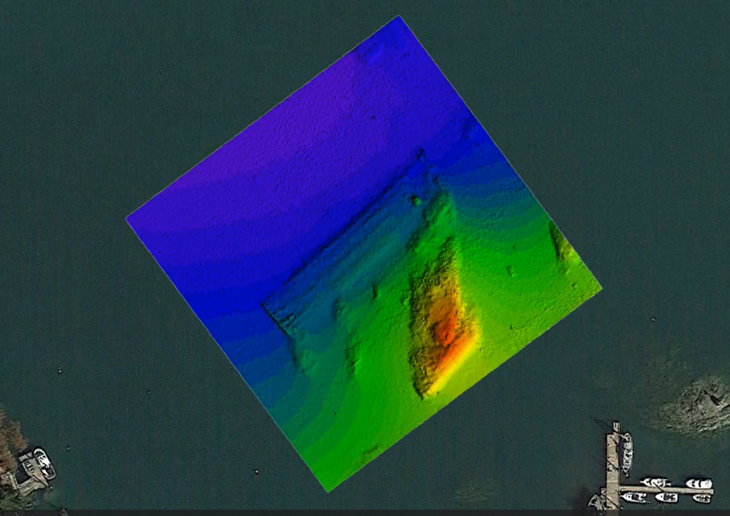
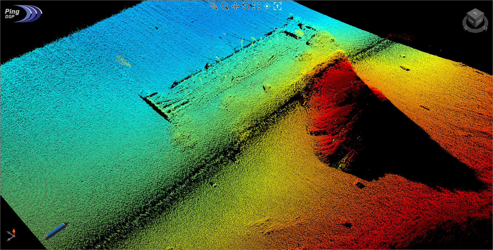
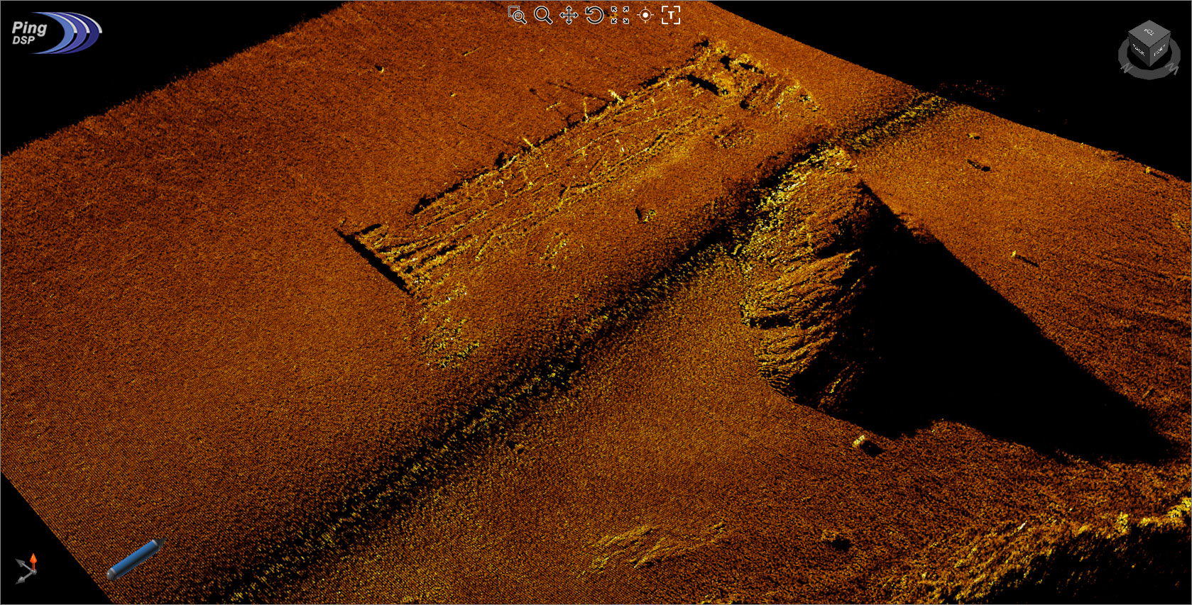
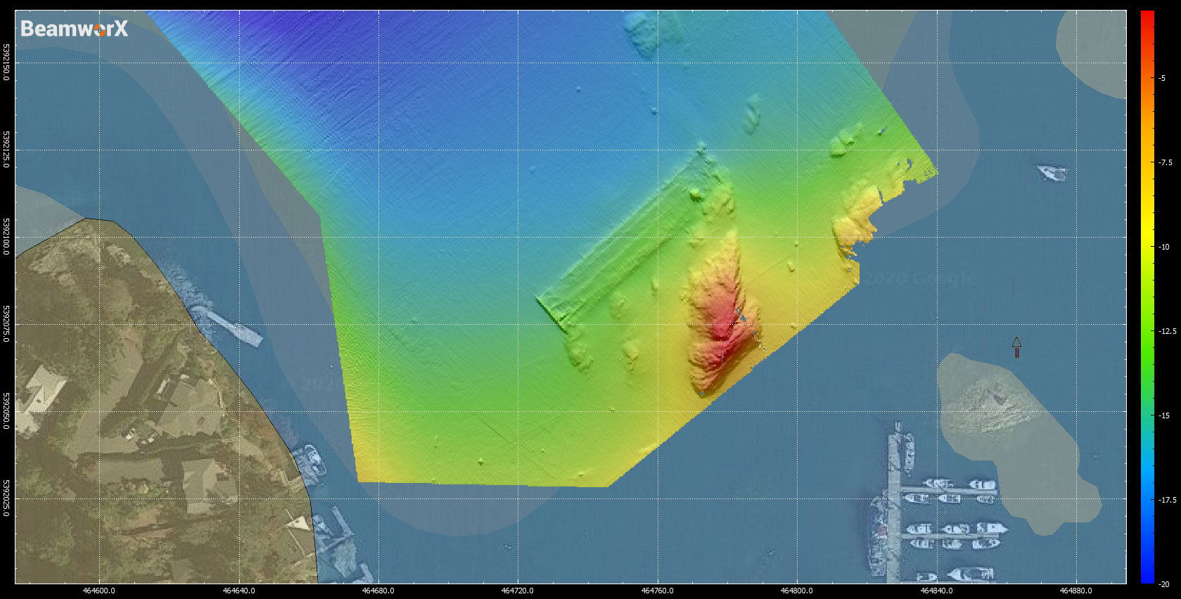
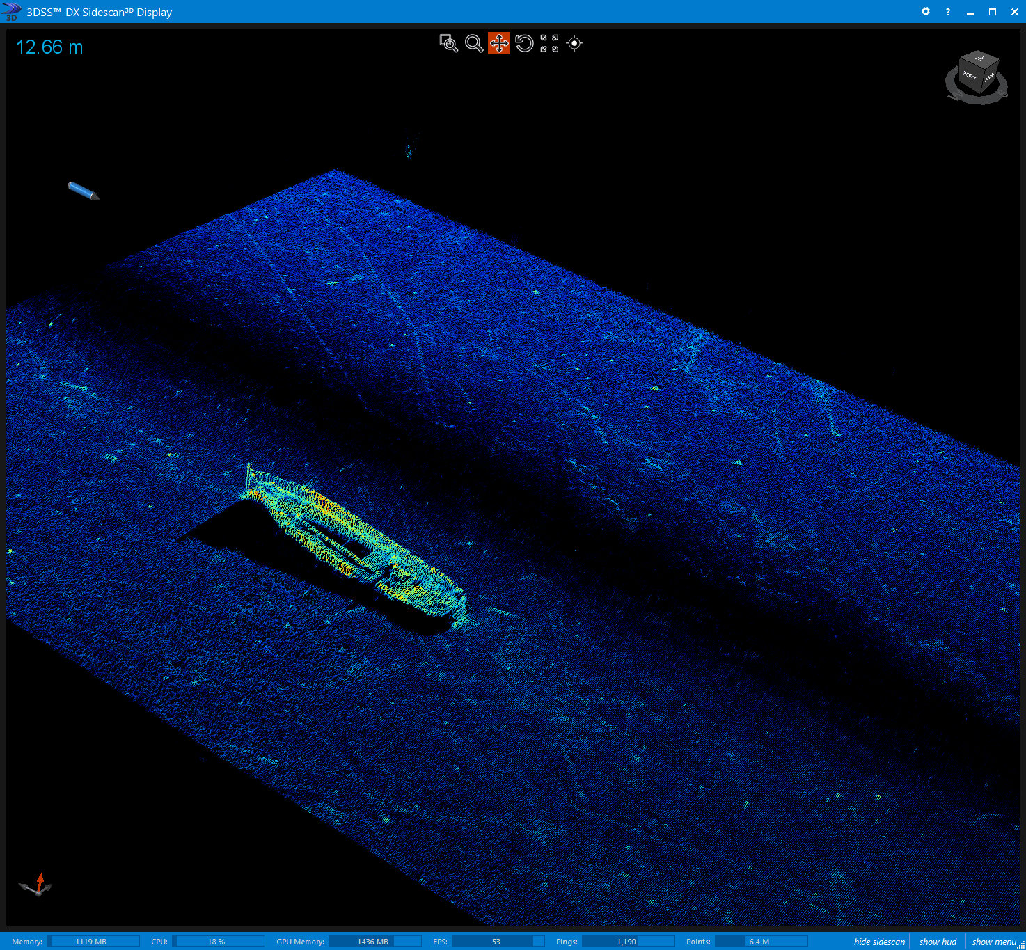
Sunken Barge just outside our office.
Just off the end of the pier outside our office at Deep Cove, there is a sunken rail barge. The 3DSS did a great job capturing a clear image of the wreck, and produced accurate bathymetry of the whole area.
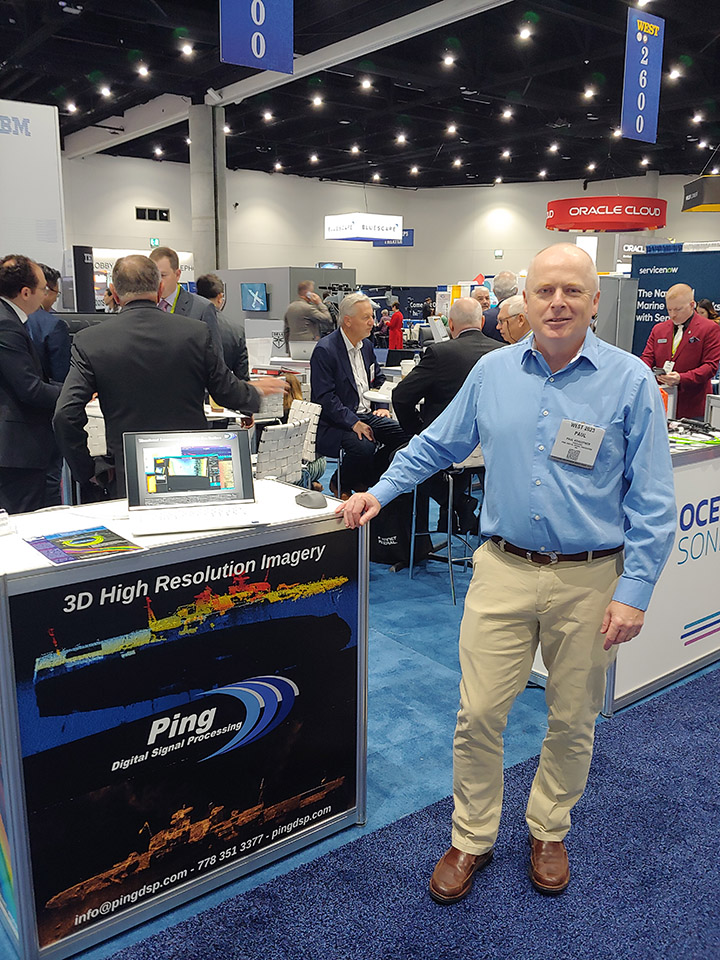
WEST 2023 - San Diego, California.
Ping DSP is greatful to have been part of the Canadian Delegation at WEST 2023. Despite the last few quiet years, the 3DSS-iDX generated a lot of buzz.
Oceanology International 2023 - San Diego, California.
After a 3-year hiatus, Ping DSP was pleased to attend OI Americas 2023. As part of the Canada Pavilion, we are proud to have showcased our 3DSS-iDX alongside other innovative Canadian technology.
Oceanology International 2023 & WEST 2023 - San Diego, California.
We are thrilled to be attending two fantstic conferences next month: Oceanology International Americas 2023 and WEST 2023. Come find our booths and see some of the exciting projects we have been working on over the last little while.
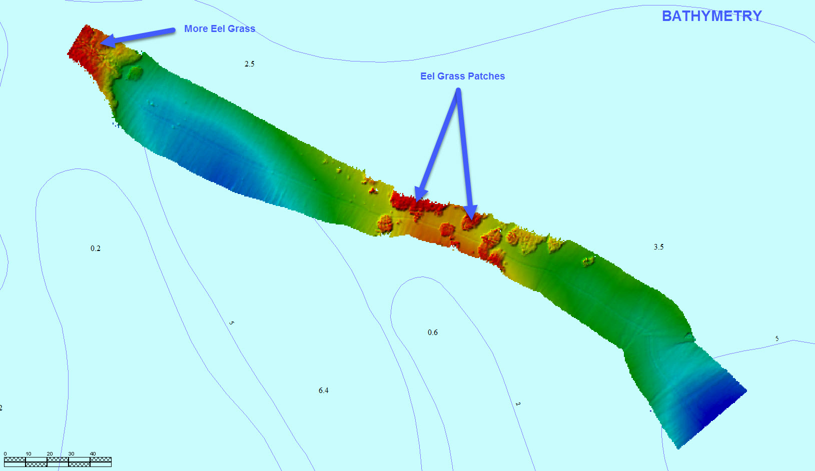
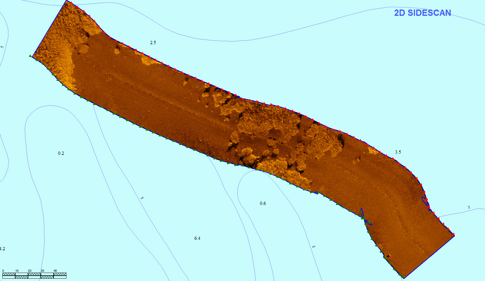
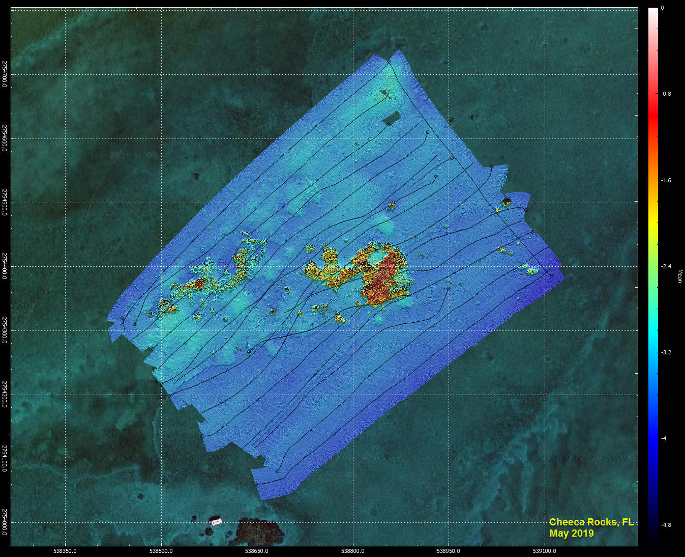
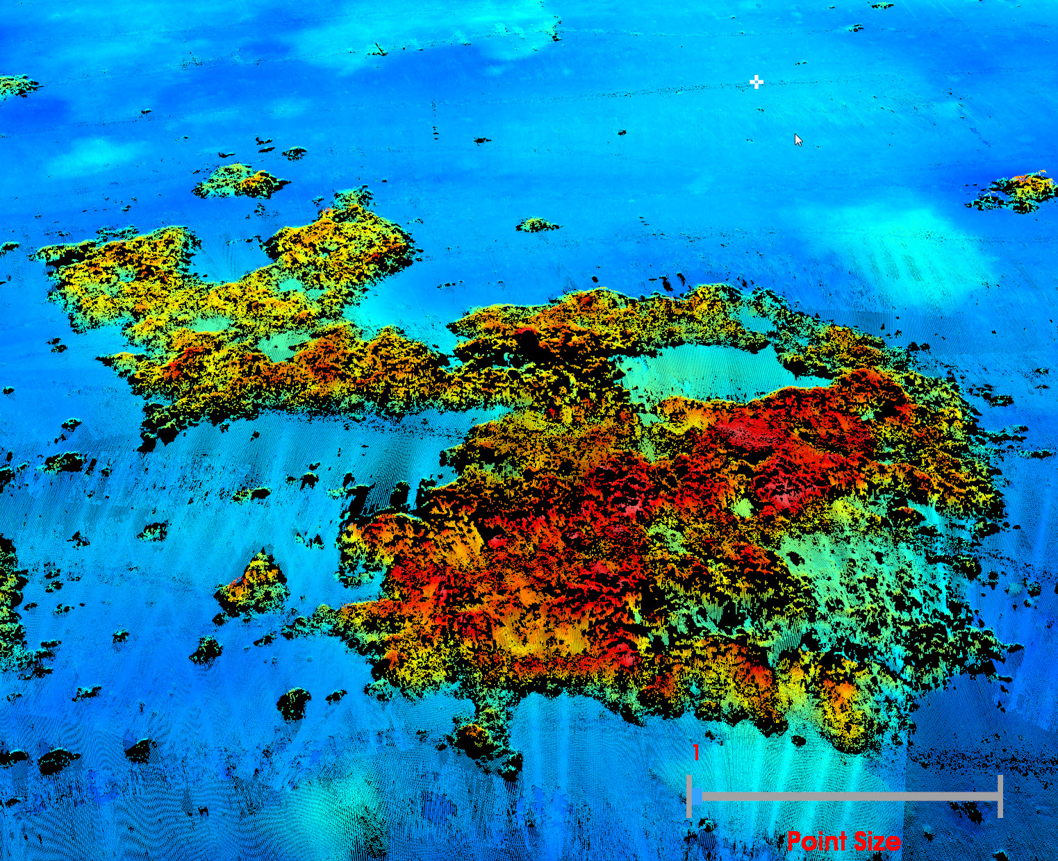
Seabottom classification example 3DSS & SonarWiz 7.
At the request of interested parties, Ping DSP demonstrates the capabilities of using 3DSS data to classify the seafloor. The example below focuses on using SonarWiz 7's automated Classification tool to distinguish between sand and vegetation on the seafloor.
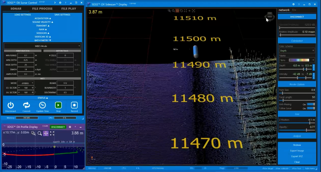
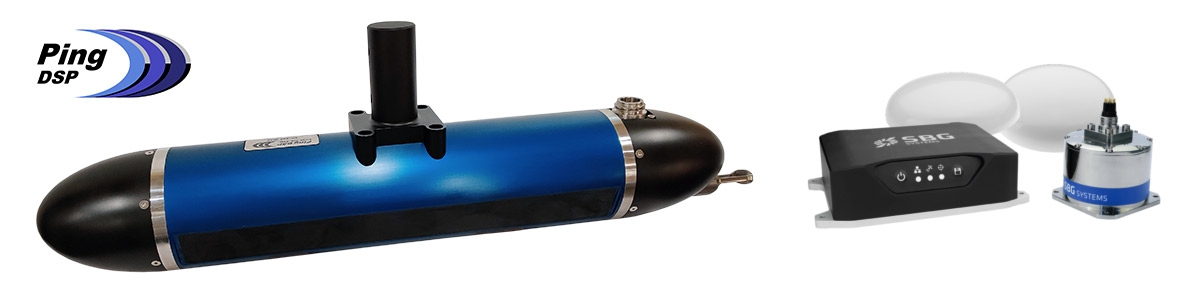
First test survey completed with 3DSS-iDX-PRO
Ping DSP completes the first test survey of the iDX-PRO with an integrated SBG Navsight Ekinox INS and Septentrio GNSS.
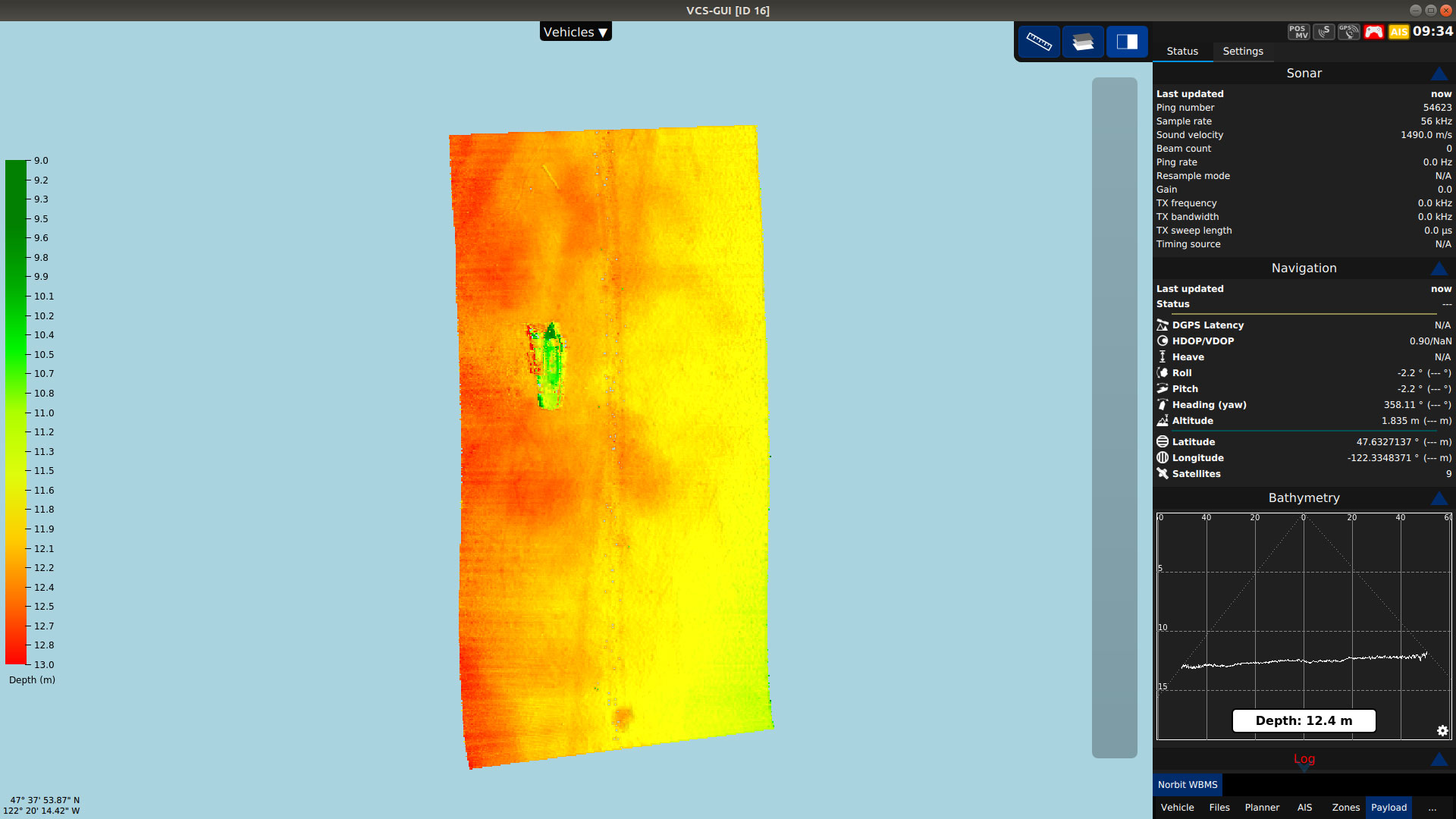
3DSS-iDX-PRO - New 3DSS Model is Released
Ping DSP is pleased to introduce a new model of the 3DSS, the iDX-PRO, featuring a fully integrated SBG Navsight Ekinox INS and Septentrio GNSS. The Ekinox is a 0.02° class instrument that together with the integrated GNSS provides a tightly coupled INS solution specifically tuned to harsh marine applications. This new compact turn-key combination of the 3DSS and Ekinox excels in shallow water mapping of rougher coastal areas and GNSS denied environments, such as under bridges.
The system collects both wide-swath IHO or better (e.g. CHS/Exclusive Order, NL Norm 1A) bathymetry and detailed 3D imagery. The 3D imagery augments the survey by providing context about specific targets in the survey area and can be used in real-time to mark and identify hazards. As with all 3DSS solutions, this new addition is competitively priced compared to MBES solutions while meeting the same hydrographic standards with a markedly higher area coverage rate particularly in shallow water.
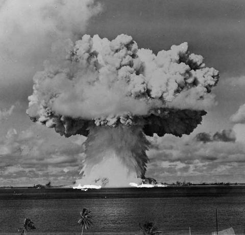
Drain the Oceans - The Atomic Ghost Fleet
Using the latest sonar technology, a high-tech expedition maps Bikini Atoll in the Pacific Ocean to reveal the world's only nuclear battlefield. The survey tells the story of the U.S. atomic experiments and the warships they destroyed, including a submarine and a mighty aircraft carrier. This is the explosive tale of the dawn of the Nuclear Age and the birth of the Cold War.
Watch online at:
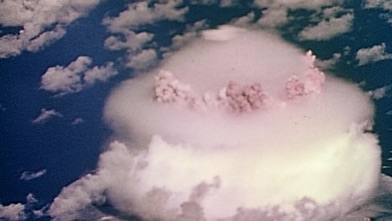
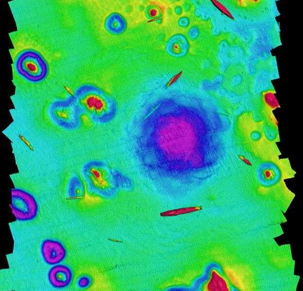
3DSS In Use - Oceanographers Map Legacy of Nuclear Tests at Bikini Atoll
Dr. Arthur Trembanis and CSHEL at the University of Delaware use 3DSS to reveal undersea craters from atomic testing conducted between 1946 and 1958. Read the full articles:
Smithsonian Magazine: Oceanographers Map Legacy of Nuclear Tests at Bikini Atoll
Eos Science News: Bikini Seafloor Hides Evidence of Nuclear Explosions
YouTube Channel: University of Delaware - Coastal Sediments Hydrodynamics and Engineering Lab
BeamworX 2019.2 Supports 3DSS-DX/iDX Sonar.
Ping DSP is excited to report that BeamworX completed the integration of 3DSS-DX/iDX drivers into NavAQ 2019.2. With this integration, NavAQ now supports real-time acquisition of ultra-wide swath bathymetry generated by the 3DSS. Additional testing of AutoClean 2019.2 was performed to confirm the compatibility of XTF files generated by the 3DSS-XTF Converter. The combination of the 3DSS-iDX sonar and BeamworX offers a turn-key wide swath bathymetry solution for price-sensitive shallow water applications requiring both high accuracy and ease-of-use.
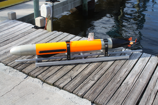
Ping DSP Releases 500m Depth Version of the 3DSS-DX-AUV Sonar.
The 3DSS-DX-AUV is an OEM version of the 3DSS-DX sonar provided to autonomous underwater vehicle (AUV) manufacturers. The OEM kit comes an advanced electronics stack and 100m depth rated transducers in its standard configuration. For more demanding applications, new 500m depth rated transducers have designed and tested by Ping DSP and are now available.
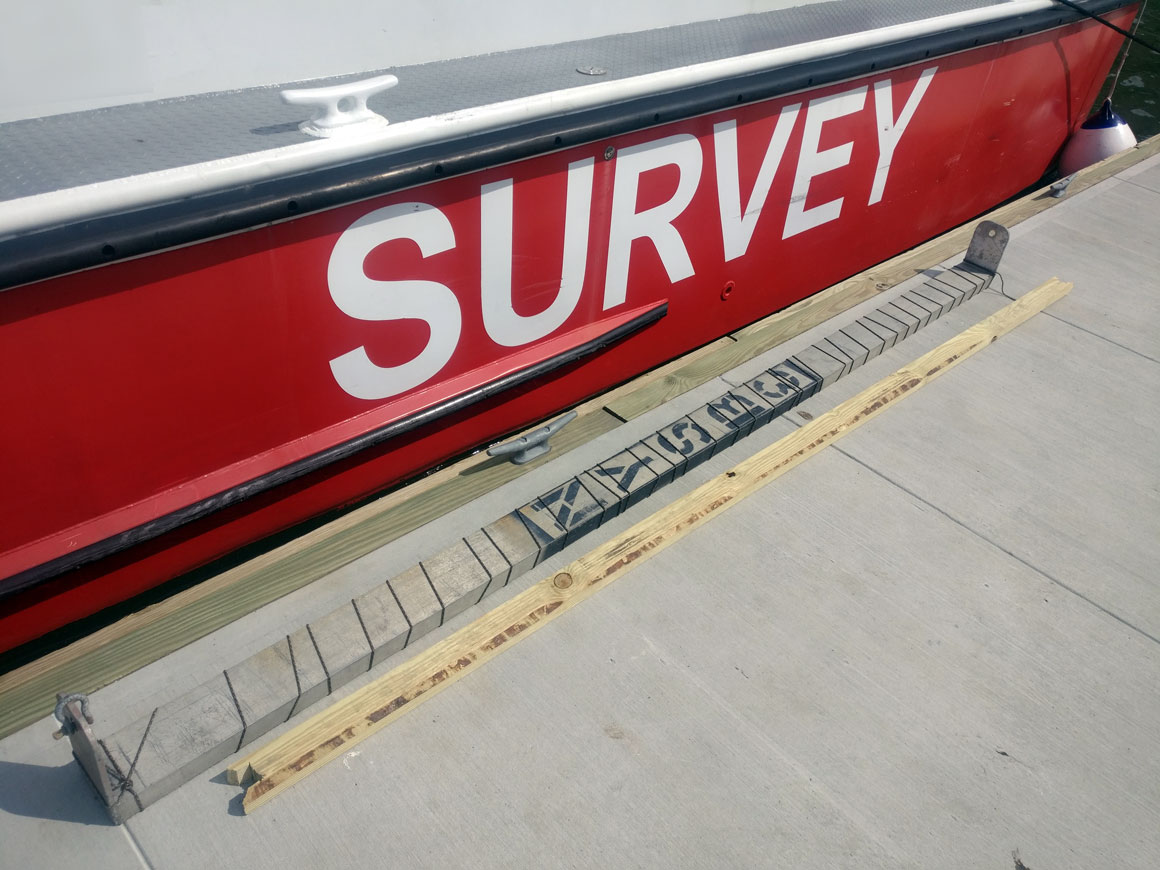
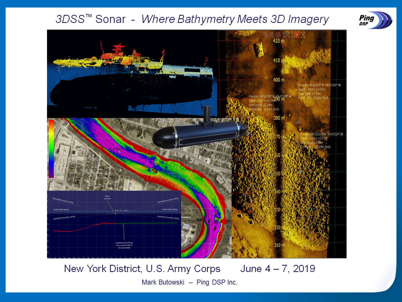
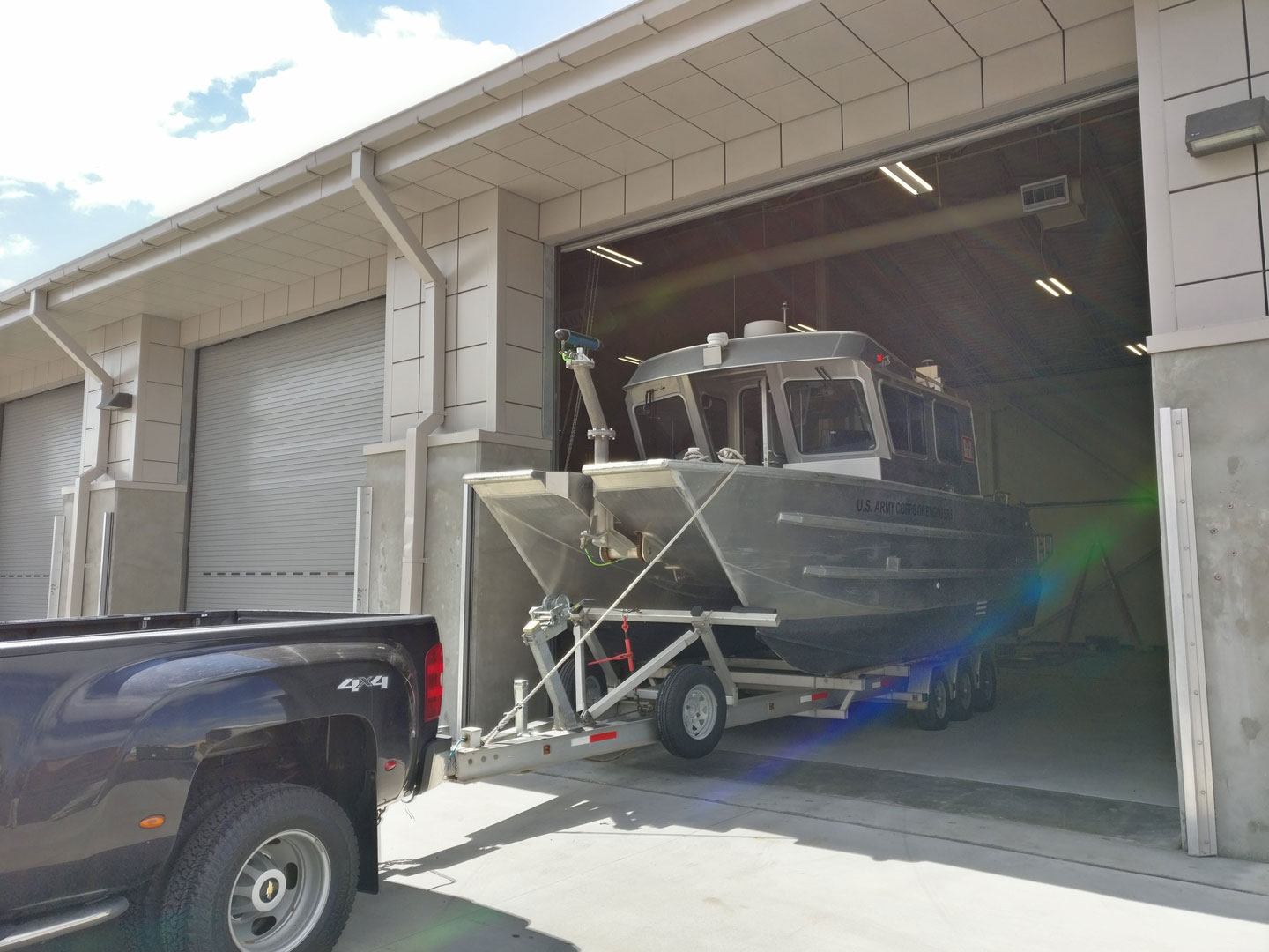
Ping DSP Conducts Training and Presents Seminar at the U.S. Army Corps Prospects Course in New York.
Dr. Paul Kraeutner, President and CEO, presented a seminar on advances in bathymetric mapping covering multibeam echosounding and pulse tracking methods such as interferometry and CAATI. Mr. Mark Butowski, Vice President and CTO, conducted a post-installation validation of 3DSS™ performance, acceptance tests, and training in support of the 3DSS-iDX. Both events were very well received, highly successful, and further Ping DSP's lead in wide swath bathymetry and 3D imaging.
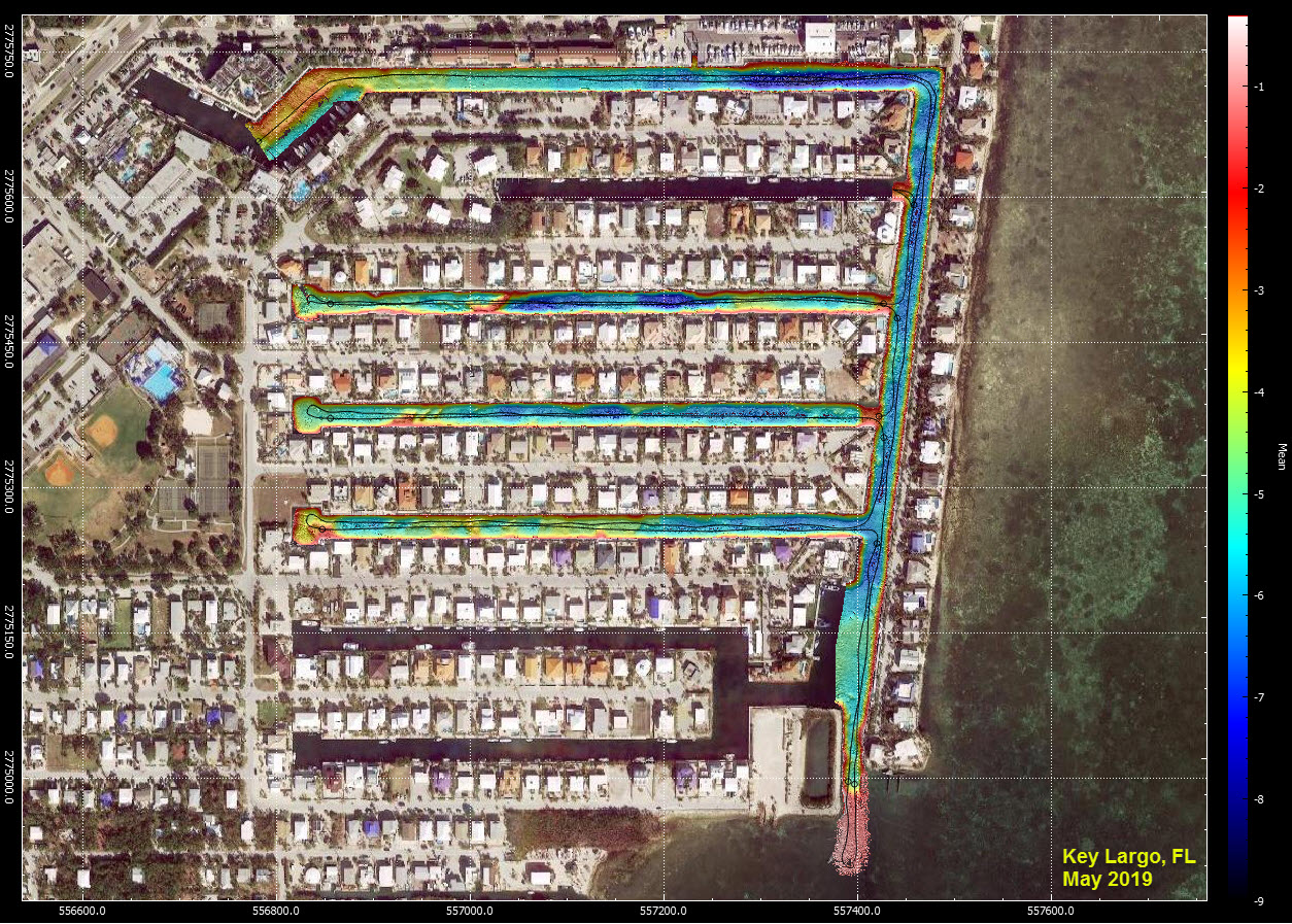
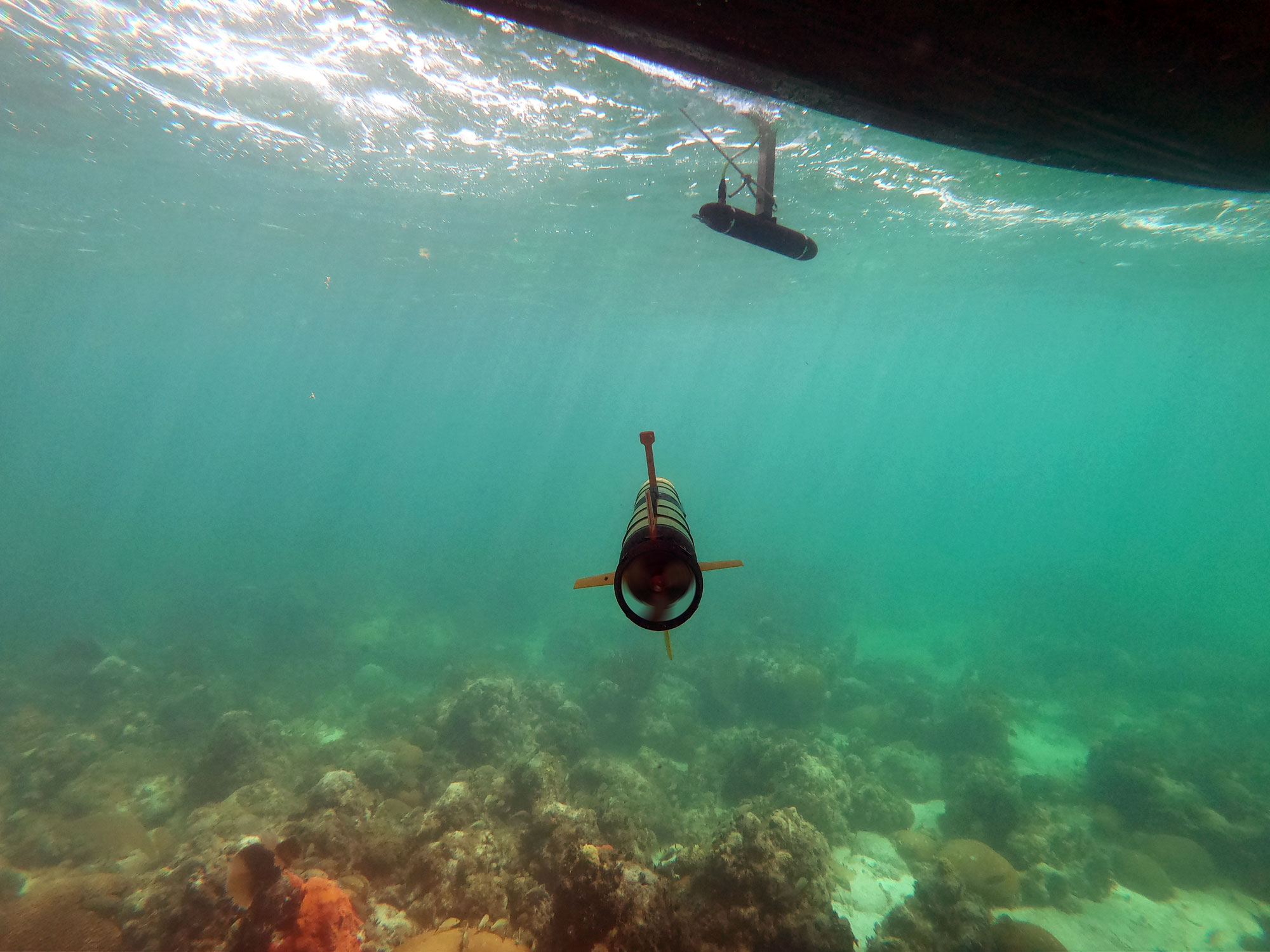
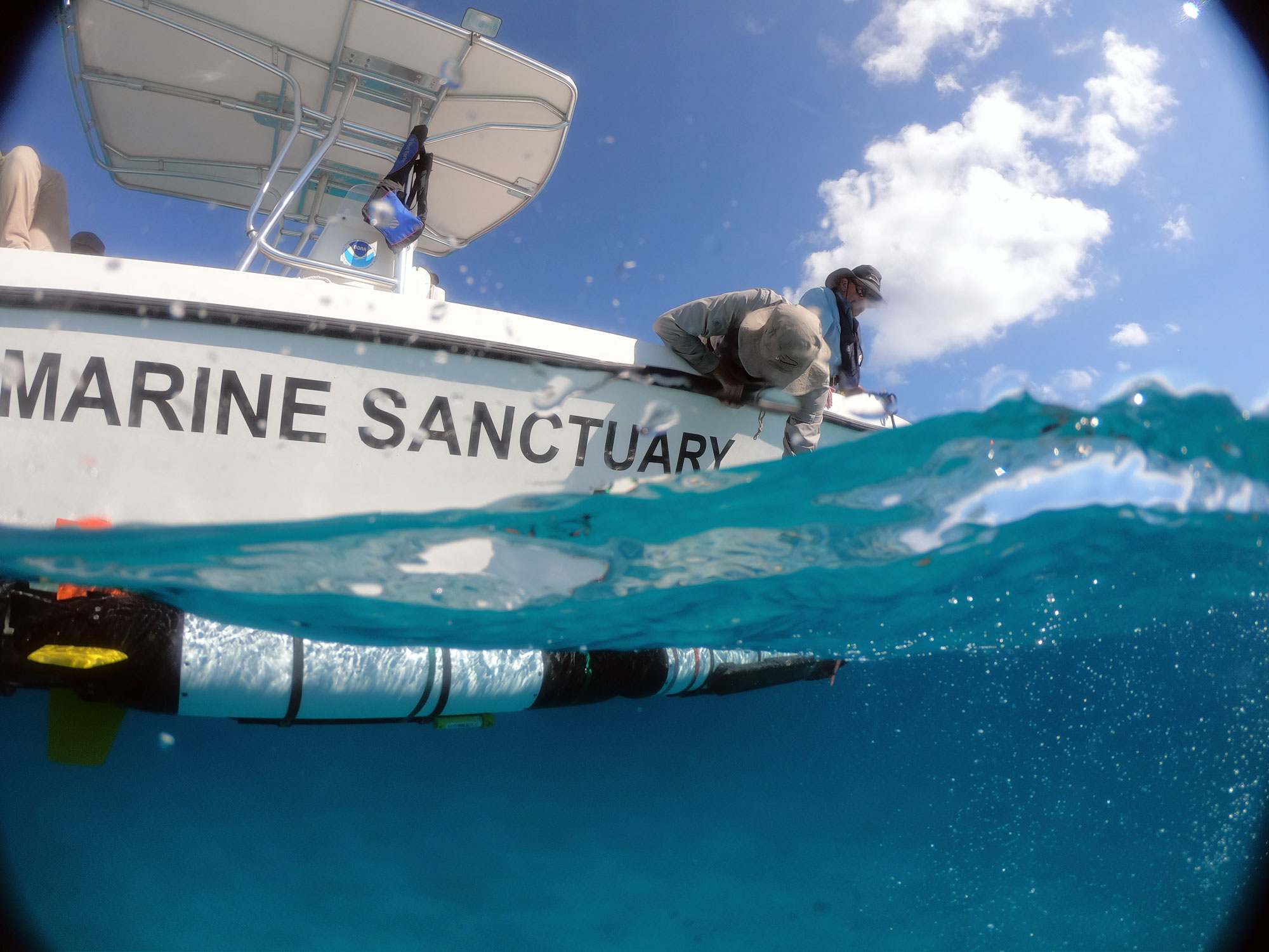
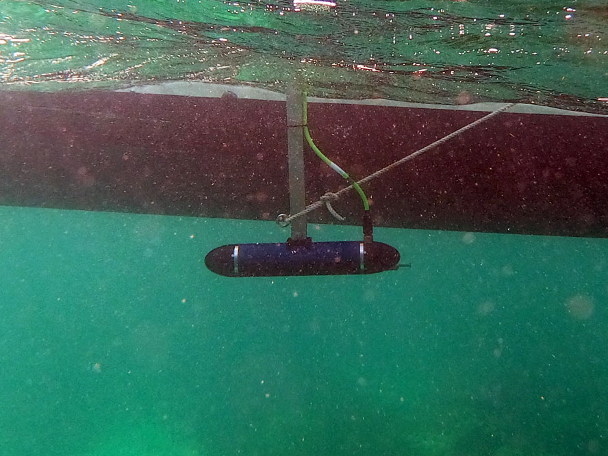
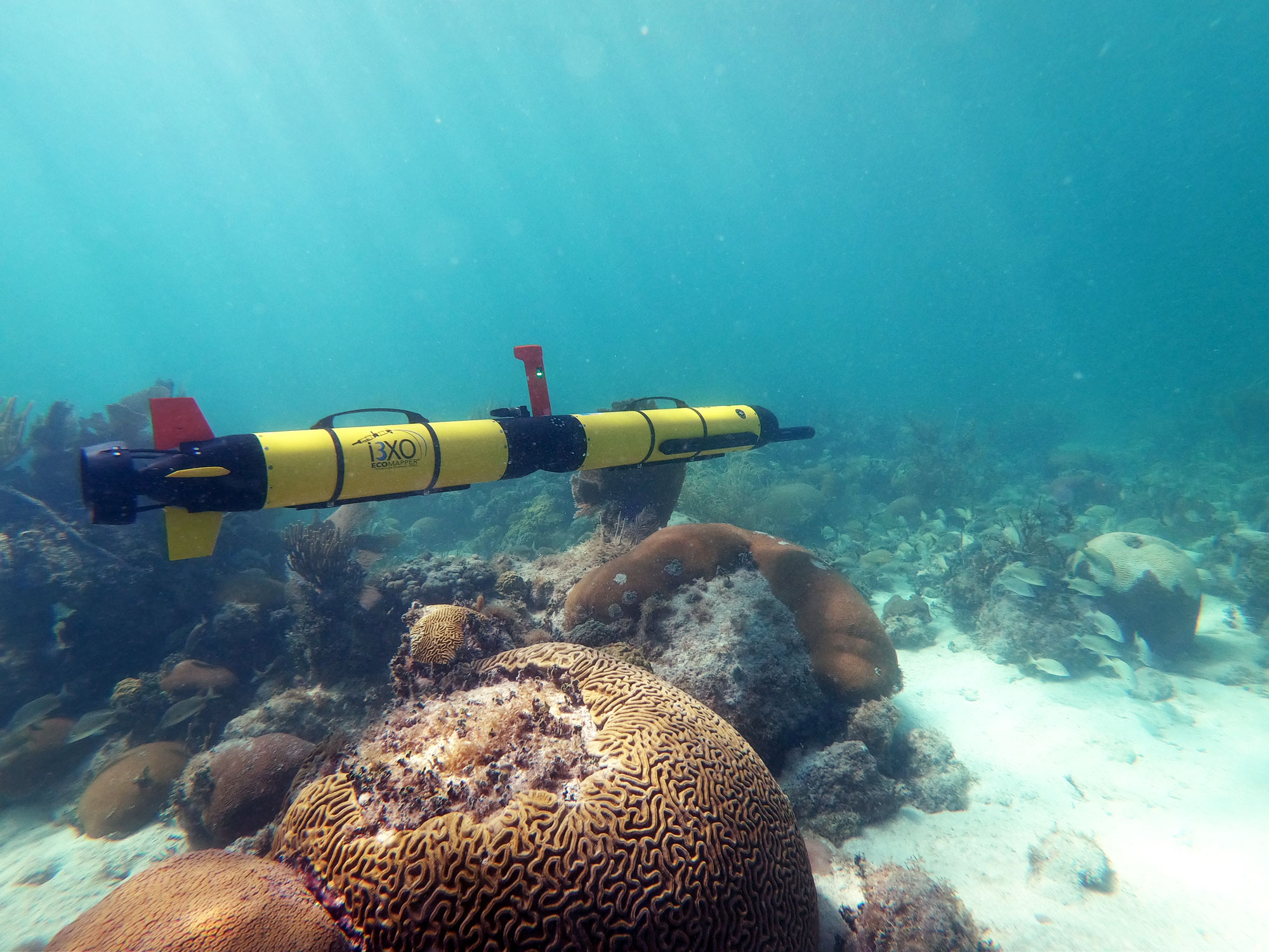
Ping DSP Jointly Demos the 3DSS for Florida Keys National Marine Sancutuary.
The FKNMS is a part of NOAA's Office of National Sanctuaries and features spectacular and unique resources such as coral reefs, shipwrecks, seagrass beds, and fisheries. The sanctuary protects the waters surrounding the Keys, extending from south of Miami westward to the Dry Tortugas. Ping DSP conducted a combined demo with L3 OceanServer Iver3 and the Xylem YSI EcoMapper showing the vast potential of these novel technologies to the sanctuary's mission.

Ocean Business 2019 - Southhampton, UK
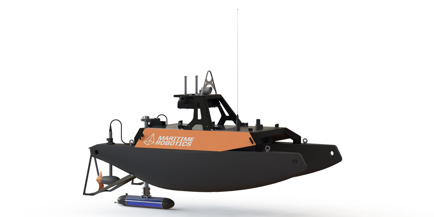
At Ocean Business this year we are proud to demonstrate the 3DSS-iDX on the Martime Robotics Otter USV platform. The 3DSS-iDX / Otter combination streamed real-time data back to shore to be viewied in the 3DSS point cloud display.
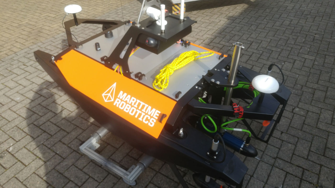
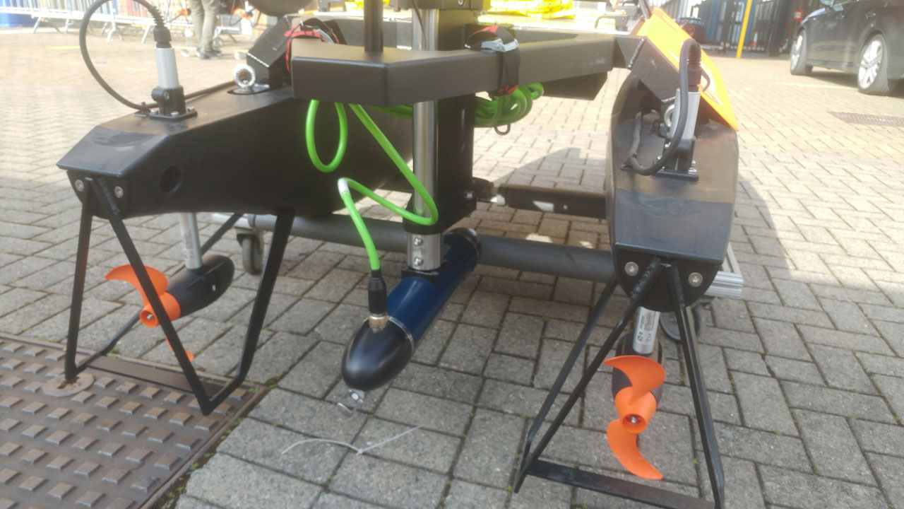
Maritime Robotics Integrates the 3DSS-iDX Sonar.
Ping DSP and Maritime Robotics joinly completed the integration of the 3DSS-iDX sonar system onto the Otter USV platform. The Otter is an easily deployable and portable USV, and provides a cost-effective turn-key solution for bathymetric surveys in sheltered waters. The turn-key 3DSS-iDX sonar provides real-time 3D point cloud imagery and ultra-wide swath 220 degree bathymetry covering from the sea surface to the sea bottom with integrated GNSS, motion, and sound velocity.
U.S. Hydro 2019 - Biloxi, Mississippi
Ping DSP attended the U.S. Hydro conference in Biloxi. The 3DSS-iDX continues to gain attention in the hydrographic community.
Ping DSP Releases Data Link Software for Streaming 3DSS Data Over a Wireless Link.
The newly released 3DSS Remote Data Link application allows for the real-time streaming of 3DSS data over a low bandwidth wirless connection. The 3DSS RDL is targeted at Unmanned Surface Vehicles (USVs) and allows the shore station to run the 3DSS 3D point cloud display and/or additional third-party hydrographic software.
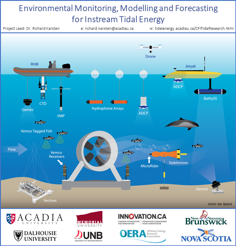
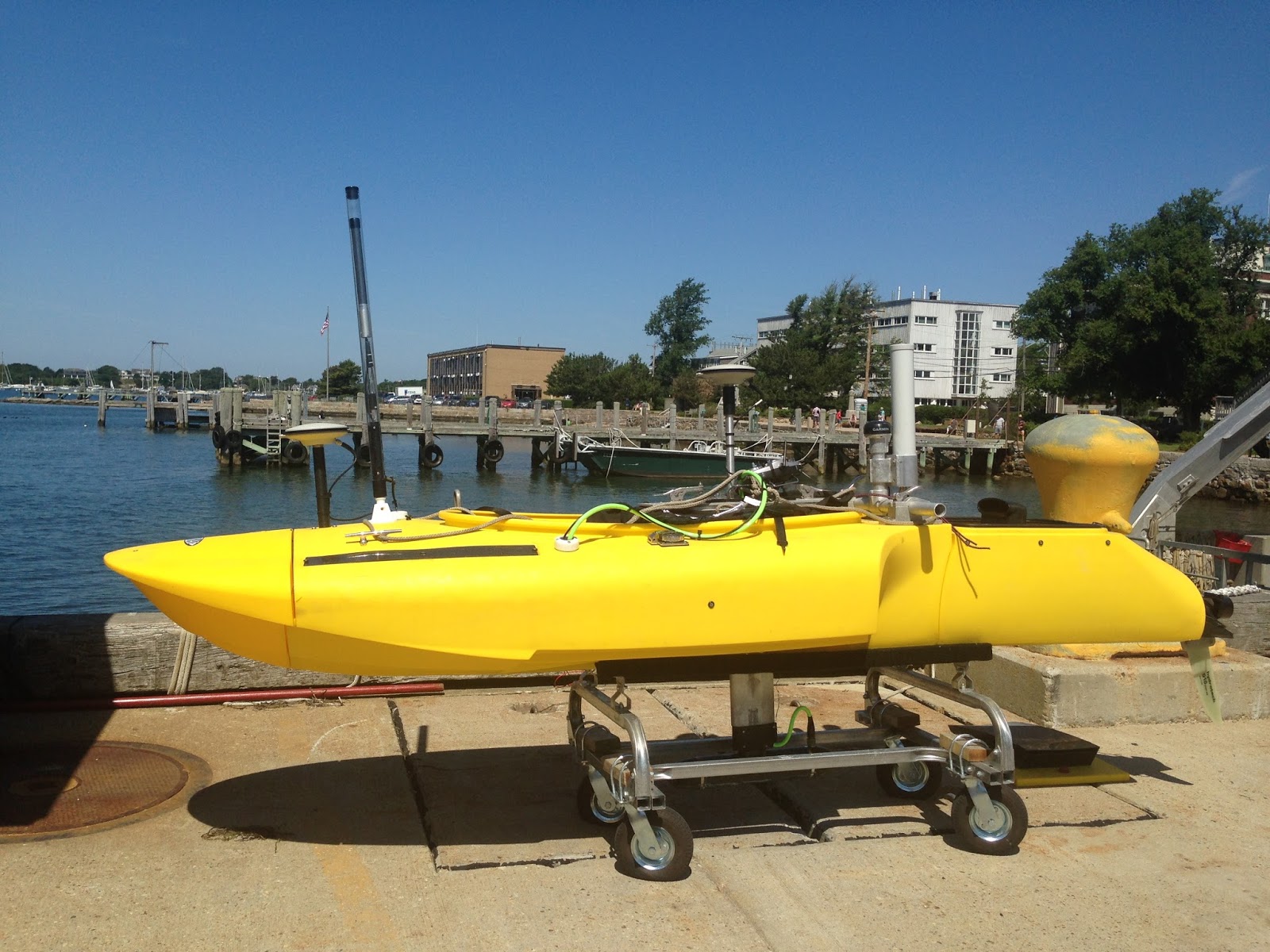
Dalhousie University Selects the 3DSS-iDX and Jetyak for Tidal Power Initiative.
The 3DSS-iDX has been selected by Dalhouise University for 3D imaging and hydrographic surveying in support of tidal energy initiative. The 3DSS-iDX will be used onboard the WHOI Jetyak platform as well as in a standalone configuration. The Jetyak is an innovative solution for shallow water surf zone operations.
HYPACK 2019 - Corpus Christi, TX.
Ping DSP started the new year with the annual HYPACK exhibition in Corpus Christi.
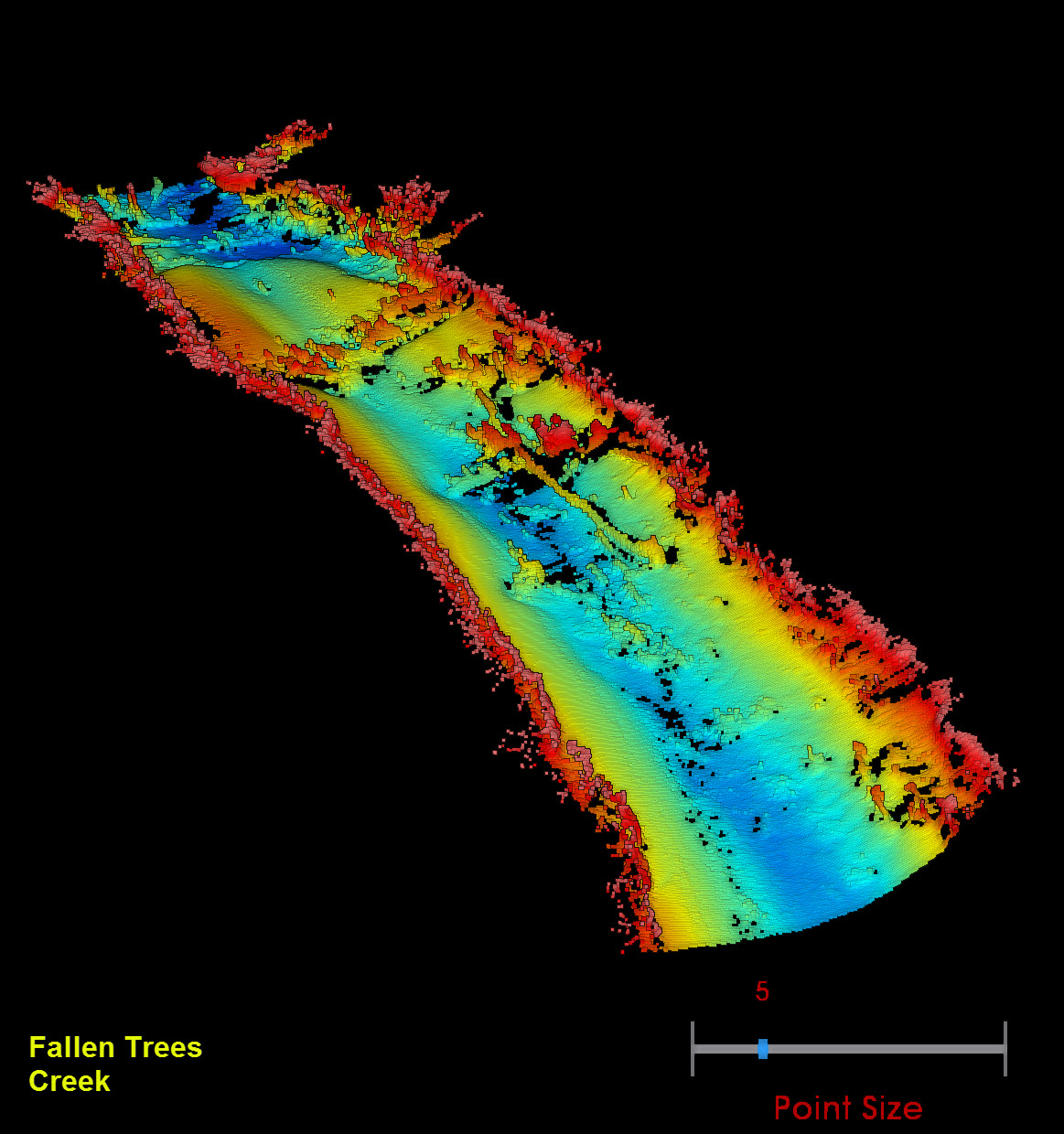
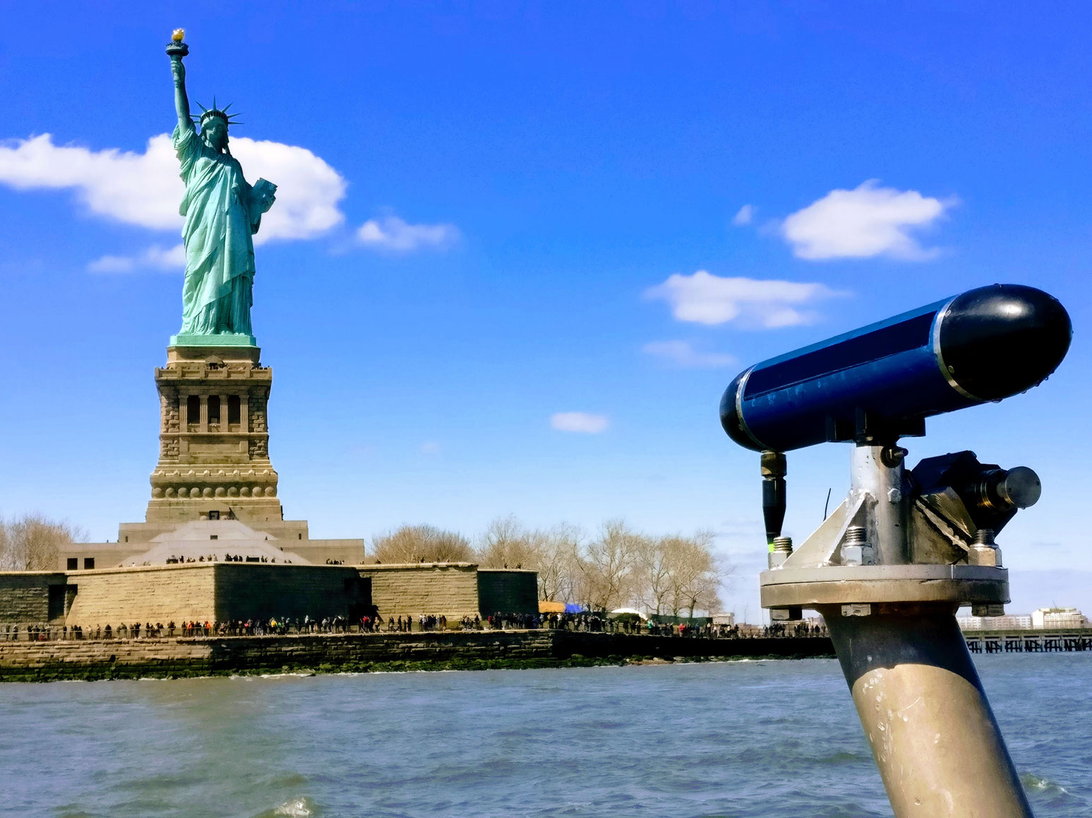
US Army Corps - New York District Selects the 3DSS-iDX.
NY District has selected the newly released 3DSS-iDX for shallow water bathymetry and 3D imagry. The 3DSS-iDX was evaluated in the murky waters of the Hudson river and the Upper New York Bay. The area is a highly industrialized estuary which features mud bottom conditions with sediment resuspension. A challange for all acoustic sensors - the 3DSS-iDX surpassed expectations.
Virginia Tech Selects the 3DSS-DX-AUV for US Navy AUV Program.
Virginia Polytechnic Institute and State University has selected the OEM variant of the 3DSS-DX sonar system for integration into their innovative VT-690 autonomous underwater vehicle.
Ping DSP Exhibits at Oceanology 2018
Ping DSP is proud to have demonstrated the new 3DSS-iDX with virtual MBES processing at Oceanology this year. The 3DSS-iDX integrates a surface sound velocity probe and a hydrographic grade INS / GNSS solution to the 3DSS-DX. The 3DSS-iDX is a true turn-key solution for ultra-wide swath shallow water hydrography.
Ping DSP Delivers Deep Water Swath Bathymetry System for Ocean Discovery XPRIZE
Ping DSP has developed a deep water version of its 3DSS-DX-AUV sonar for Virginia Tech’s DEEP-X program. In conjunction with the DEEP-X Javelin AUV, the 3DSS™ sonar provides high resolution 3D imagery and wide swath bathymetry at depths as deep as 4000m. See our AUV package on our Products Page .
Ping DSP Unveils Turnkey Shallow Water Wide Swath Bathymetry Solution
The introduction of the 3DSS-iDX reaffirms Ping DSP as the leading innovator and developer of sonar technology for shallow water hydrography and imaging. Click the link above to learn more or check out our updated Products Page .
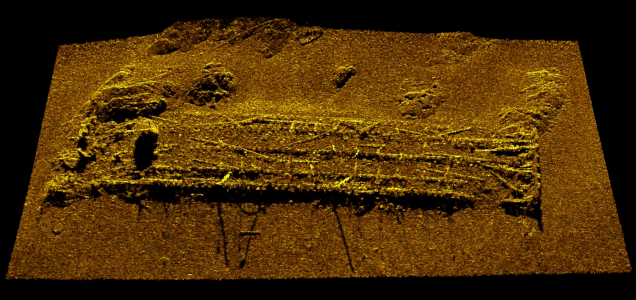
Ping-DSP Releases Imagery of J.E. Boyden
Ping DSP continues to enable multirole capability without compromise to customers across dozens of industries including Marine Archaeology. The imaging of J.E. Boyden by Ping DSP demonstrates the capability of the 3DSS to perform fine scale imagery while simultaneously outputting bathymetry exceeding IHO S-44 standards.
Ping DSP Releases MBES Mode Bathymetry Engine
Ping DSP raises the bar for shallow water mapping and imaging with the introduction of its new MBES Bathymetry Engine. The new MBES Mode introduces user control of sounding beam widths as narrow as 0.25 degrees, and beam densities of up to 1024 beams over a maximum sector size of 220 degrees. Follow the link above to read more!
Ping DSP Moves to New Office and Workspace
Ping DSP has moved to a larger office and workspace to continue its exciting work and allow for future growth. Our new address is now 10990 Madrona Drive, North Saanich BC.
Ping DSP Appoints Authorized Sales Agency for Benelux and Germany
Ping DSP is excited to name Geometius as an authorized sales agency to represent their line of 3D Sidescan sonar systems. Learn more...

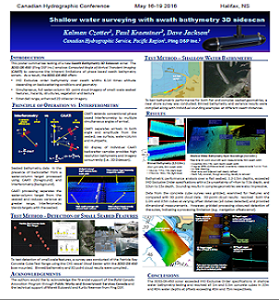
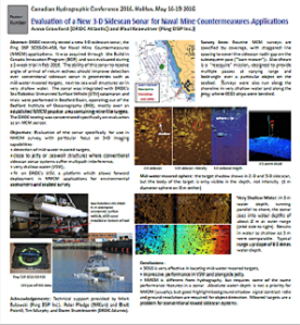
2016 Canadian Hydrographic Conference (16-19 May 2016, Halifax)
Ping DSP in collaboration with CHS Pacific and DRDC Atlantic presents at the 2016 Canadian Hyrdographic Conference! Check out the posters below.
Oceanology International 2016 (15-17 March 2016, London, Excel)
Ping DSP exhibits the 3DSS-DX-450 3D side scan sonar at Oceanology International 2016. Please come visit us in the Canada Pavilion (Booth E401).

Defence Research and Development Canada (DRDC), Atlantic
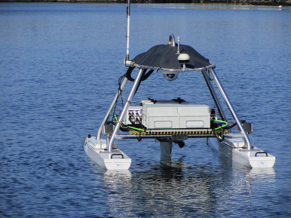
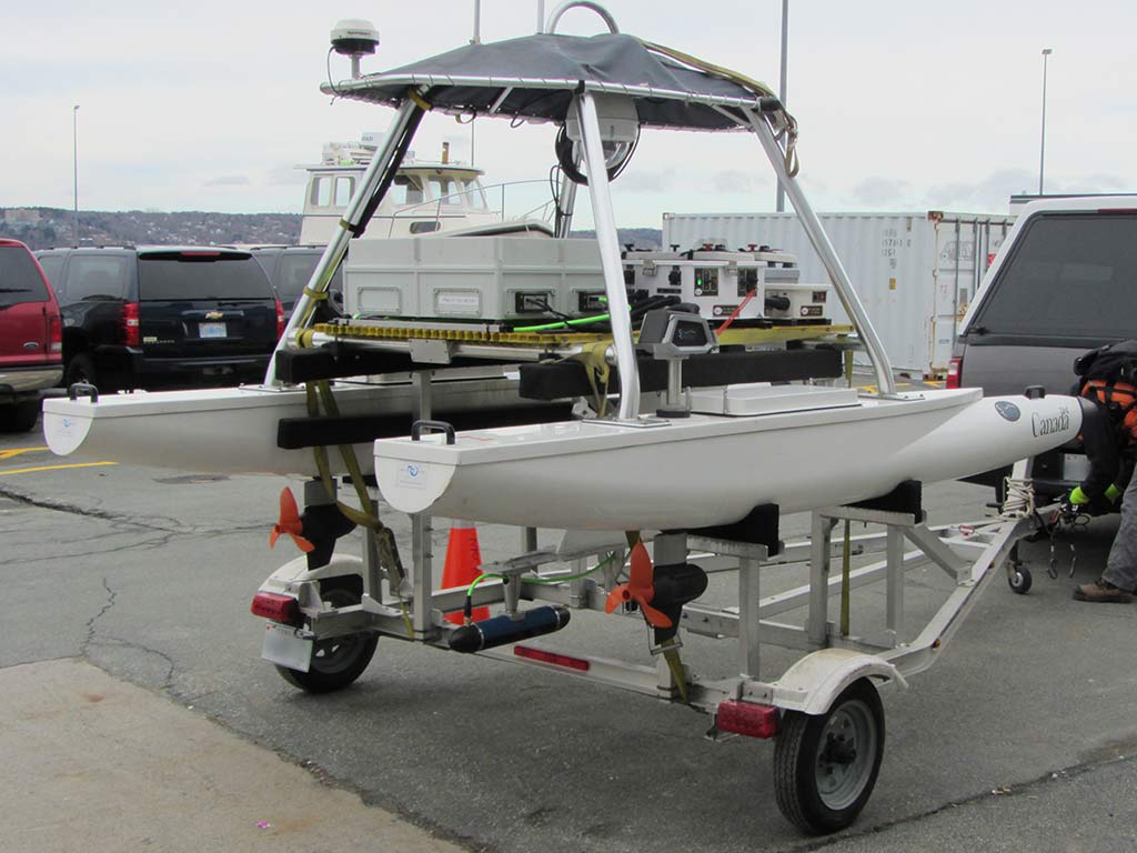
Ping DSP and DRDC Atlantic complete integration of the 3DSS-DX-450 side scan sonar onto a 3m catamaran ASV.

Institute of Ocean Sciences (IOS) evalutes the 3DSS-DX
IOS and Ping DSP perform shallow water white zone survey and 3D target detection survey.

Service Hydrographique du Canada (SHC), Quebec evaluates the 3DSS-DX
Ping DSP carry out hydrographic testing with SHC Quebec in Rimouski, Quebec. SHC Quebec compares the 3DSS-DX Bathymetric Side Scan against a reference area surveyed with several MBES systems.
Ping DSP Appoints Authorized Sales Agency for the Japan
Ping DSP is excited to name Science Engineering Associates Corporation (SEA) of Japan as an authorized sales agency to represent their new line of 3D Sidescan sonar systems. Learn more...

U.S. HYDRO 2015
Ping DSP exhibits the 3DSS-DX-450 3D Side Scan at U.S. Hydro 2015 in Mayland, come visit us our booth.

Ping DSP Appoints Authorized Sales Agency for the Pacific Northwest Region
Ping DSP has named SUBSEA 20/20, Inc. the first authorized sales agency to represent their new line of 3D Sidescan sonar systems. Learn more...

Shallow Water Mapping of Bazan Bay.
A high density bathymetric survey spanning water depths of 3m to 25m of Bazan Bay near Victoria, BC was completed with great success. The efficiency and bathymetric results of the survey highlighted the benefits of the 3DSS-DX sonar in shallow water mapping applications.
Third Party Software Support.
3DSS-DX software drivers are now available for Hypack 2014 (Hypack Inc), SonarWiz5 (Chesapeake Technology Inc) and GeoDAS (OIC Inc.).
Launch of 3DSS-DX-450 True 3D Sidescan.
Ping DSP Inc. introduces the 3DSS-DX-450, the first true 3D Sidescan at Oceanology International 2014. Please visit us in the Canada Pavilion (Booth P200).